
File:Georgia state route 4 map.png
Size of this preview: 800 × 568 pixels. Other resolutions: 320 × 227 pixels | 640 × 455 pixels | 1,024 × 727 pixels | 1,280 × 909 pixels | 2,061 × 1,464 pixels.
Original file (2,061 × 1,464 pixels, file size: 656 KB, MIME type: image/png)
| This is a file from the Wikimedia Commons. Information from its description page there is shown below. Commons is a freely licensed media file repository. You can help. |
Summary
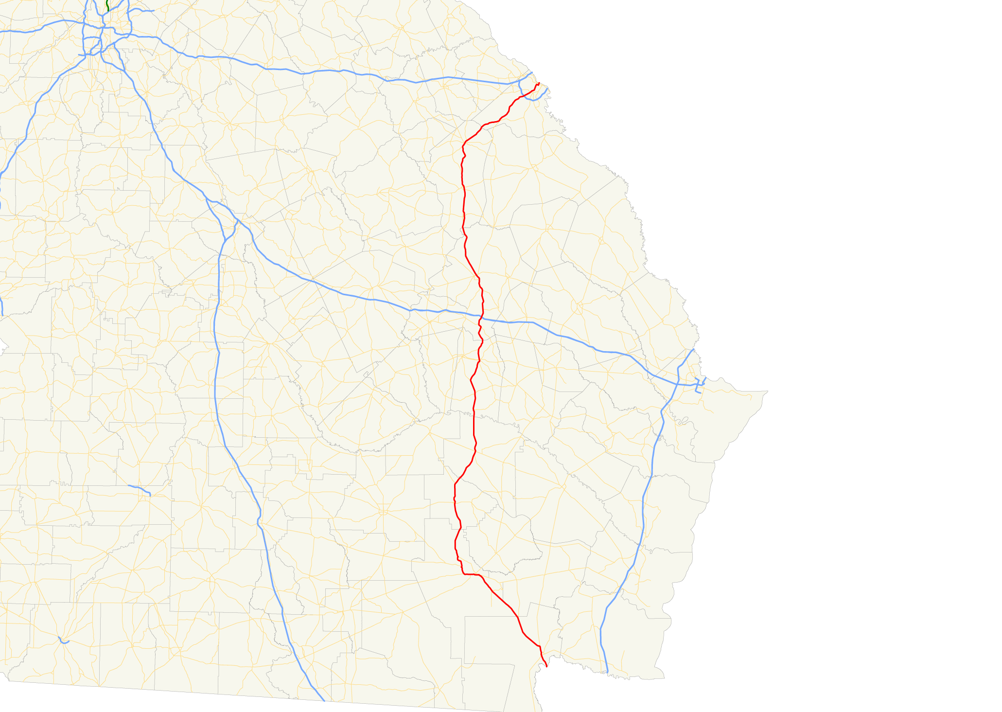
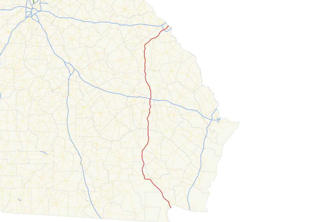
| Description | Map of Georgia State Route 4 |
| Date | 11/3/06 |
| Source | Own work |
| Author | myself |
| Permission (Reusing this file) |
all rights released |
Licensing
| I, the copyright holder of this work, release this work into the public domain. This applies worldwide. In some countries this may not be legally possible; if so: I grant anyone the right to use this work for any purpose, without any conditions, unless such conditions are required by law. |
File history
Click on a date/time to view the file as it appeared at that time.
| Date/Time | Thumbnail | Dimensions | User | Comment | |
|---|---|---|---|---|---|
| current | 02:55, 4 November 2006 | | 2,061 × 1,464 (656 KB) | HowardSF | {{Information |Description= Map of Georgia State Route 2 |Source=own work |Date= 11/3/06 |Author= myself |Permission= all rights released |other_versions= }} Category:Georgia State Route Maps |
File usage
The following page uses this file:
Global file usage
The following other wikis use this file:
- Usage on www.wikidata.org