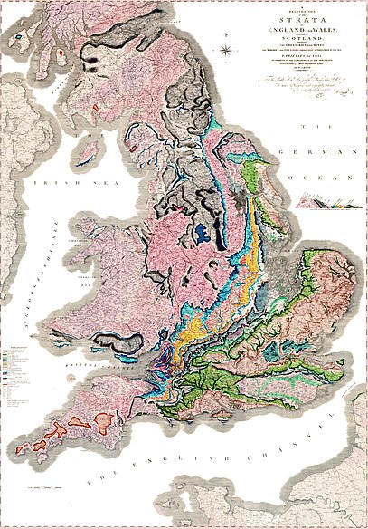
File:Geological map Britain William Smith 1815.jpg
Appearance

Size of this preview: 407 × 600 pixels. Other resolutions: 163 × 240 pixels | 325 × 480 pixels | 521 × 768 pixels | 1,200 × 1,769 pixels.
Original file (1,200 × 1,769 pixels, file size: 456 KB, MIME type: image/jpeg)
File history
Click on a date/time to view the file as it appeared at that time.
| Date/Time | Thumbnail | Dimensions | User | Comment | |
|---|---|---|---|---|---|
| current | 21:03, 29 May 2024 |  | 1,200 × 1,769 (456 KB) | Anticline | Reverted to version as of 00:45, 11 December 2008 (UTC) as this image more accurately reflects the colouring and appearance of the map |
| 14:45, 20 October 2014 |  | 2,000 × 2,871 (4.63 MB) | Ivtorov | edited colors, crop. | |
| 00:45, 11 December 2008 |  | 1,200 × 1,769 (456 KB) | Gump Stump | {{Information |Description=The first geological map of Britain, published by William Smith in 1815. |Source=[http://www.livescience.com/php/multimedia/imagedisplay/img_display.php?pic=051031_first_map_02.jpg LiveScience Image Gallery] Scan by the Library |
File usage
The following 10 pages use this file:
Global file usage
The following other wikis use this file:
- Usage on ar.wikipedia.org
- Usage on bg.wikipedia.org
- Usage on bn.wikipedia.org
- Usage on ca.wikipedia.org
- Usage on de.wikipedia.org
- Usage on es.wikipedia.org
- Usage on fr.wikipedia.org
- Usage on fy.wikipedia.org
- Usage on gl.wikipedia.org
- Usage on he.wikipedia.org
- Usage on hy.wikipedia.org
- Usage on it.wikipedia.org
- Usage on ja.wikipedia.org
- Usage on ka.wikipedia.org
- Usage on kk.wikipedia.org
- Usage on la.wikipedia.org
- Usage on ms.wikipedia.org
- Usage on nds-nl.wikipedia.org
- Usage on nl.wikipedia.org
- Usage on ro.wikipedia.org
- Usage on ru.wikipedia.org
View more global usage of this file.

