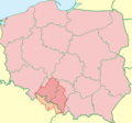
File:Górny Śląsk TT mapa.png
Appearance

Size of this preview: 642 × 600 pixels. Other resolutions: 257 × 240 pixels | 514 × 480 pixels | 808 × 755 pixels.
Original file (808 × 755 pixels, file size: 130 KB, MIME type: image/png)
File history
Click on a date/time to view the file as it appeared at that time.
| Date/Time | Thumbnail | Dimensions | User | Comment | |
|---|---|---|---|---|---|
| current | 20:47, 12 February 2024 |  | 808 × 755 (130 KB) | Uostofchuodnego | Reverted to version as of 19:55, 14 April 2023 (UTC). Newer version based on feelings, and not on last administrative limits. |
| 17:07, 12 August 2023 |  | 808 × 755 (129 KB) | Flagowy1 | poprawki | |
| 19:55, 14 April 2023 |  | 808 × 755 (130 KB) | Kolończyk | Uploaded a work by Tymoteusz Trzewiczek from paint.net with UploadWizard |
File usage
The following page uses this file:
Global file usage
The following other wikis use this file:
- Usage on ru.wikipedia.org
- Usage on szl.wikipedia.org
- Usage on uk.wikipedia.org
