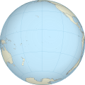
File:French Polynesia (orthographic projection).svg
Appearance

Size of this PNG preview of this SVG file: 550 × 550 pixels. Other resolutions: 240 × 240 pixels | 480 × 480 pixels | 768 × 768 pixels | 1,024 × 1,024 pixels | 2,048 × 2,048 pixels.
Original file (SVG file, nominally 550 × 550 pixels, file size: 744 KB)
File history
Click on a date/time to view the file as it appeared at that time.
| Date/Time | Thumbnail | Dimensions | User | Comment | |
|---|---|---|---|---|---|
| current | 12:50, 5 October 2010 |  | 550 × 550 (744 KB) | Gringer | {{Information |Description={{en|1=A map of the hemisphere centred on French Polynesia, using an orthographic projection, created using gringer's Perl script with Natural Earth Data (1:50000 resolution, simplified to 0.25px).}} |Source={{own}} |Author=[[Us |
File usage
The following page uses this file:
Global file usage
The following other wikis use this file:
- Usage on ca.wikipedia.org
- Usage on de.wikipedia.org
- Usage on diq.wikipedia.org
- Usage on eu.wikipedia.org
- Usage on fi.wiktionary.org
- Usage on fr.wikinews.org
- Usage on ga.wikipedia.org
- Usage on glk.wikipedia.org
- Usage on gl.wikipedia.org
- Usage on ha.wikipedia.org
- Usage on ht.wikipedia.org
- Usage on mn.wikipedia.org
- Usage on mzn.wikipedia.org
- Usage on nds.wikipedia.org
- Usage on tt.wikipedia.org
- Usage on uk.wikipedia.org
- Usage on vec.wikipedia.org
- Usage on www.wikidata.org
- Usage on zh-yue.wikipedia.org
- Usage on zh.wikipedia.org

