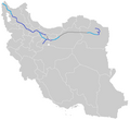
File:Freeway 2-Map-IR.png
Appearance

Size of this preview: 652 × 600 pixels. Other resolutions: 261 × 240 pixels | 522 × 480 pixels | 895 × 823 pixels.
Original file (895 × 823 pixels, file size: 29 KB, MIME type: image/png)
File history
Click on a date/time to view the file as it appeared at that time.
| Date/Time | Thumbnail | Dimensions | User | Comment | |
|---|---|---|---|---|---|
| current | 17:30, 15 January 2024 |  | 895 × 823 (29 KB) | Amir mohammad13861428 | Reverted to version as of 00:04, 21 February 2021 (UTC) |
| 22:21, 3 March 2021 |  | 895 × 823 (29 KB) | BasilLeaf | update | |
| 00:04, 21 February 2021 |  | 895 × 823 (29 KB) | BasilLeaf | Update - Ghadir Expressway | |
| 04:02, 8 October 2019 |  | 895 × 823 (28 KB) | BasilLeaf | colour shade update | |
| 08:29, 12 November 2017 |  | 895 × 823 (27 KB) | BasilLeaf | User created page with UploadWizard |
File usage
The following page uses this file:
Global file usage
The following other wikis use this file:
- Usage on fa.wikipedia.org
- Usage on nl.wikipedia.org
- Usage on tr.wikipedia.org
