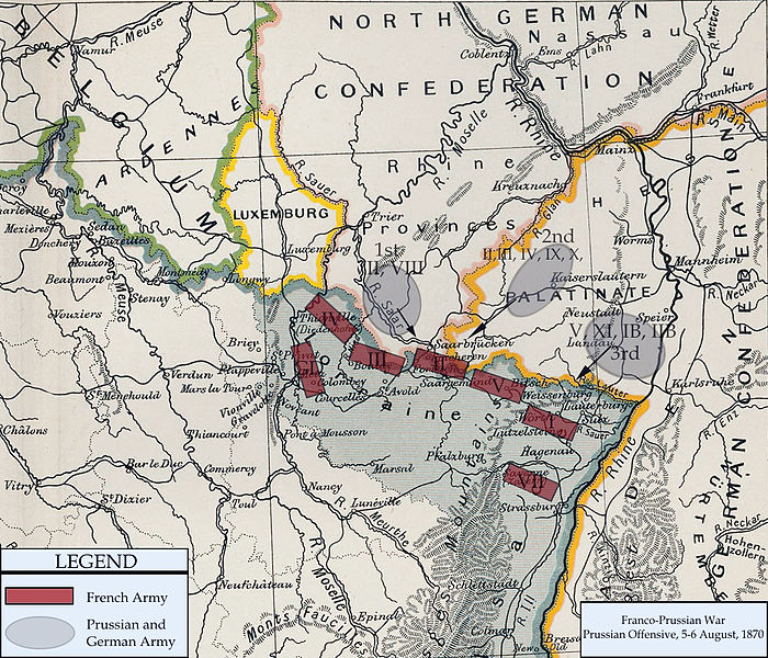
File:FrancoPrussianWar5to6Aug1870.jpg
Appearance

Size of this preview: 700 × 600 pixels. Other resolutions: 280 × 240 pixels | 560 × 480 pixels | 896 × 768 pixels | 1,083 × 928 pixels.
Original file (1,083 × 928 pixels, file size: 1.15 MB, MIME type: image/jpeg)
File history
Click on a date/time to view the file as it appeared at that time.
| Date/Time | Thumbnail | Dimensions | User | Comment | |
|---|---|---|---|---|---|
| current | 20:13, 15 February 2011 |  | 1,083 × 928 (1.15 MB) | DIREKTOR | Repairs |
| 20:57, 3 January 2008 |  | 1,083 × 928 (1.04 MB) | Monsieurdl | == Summary == {{Information |Description=Franco-Prussian War map of 1870 |Source=Cambridge Modern History Atlas |Date=1912 |Author=Edited by A.W.Ward, G.W.Prothero, and Stanley Leathes }} I adapted the map to reflect the state of French and Prussian/Germ |
File usage
The following 4 pages use this file:
Global file usage
The following other wikis use this file:
- Usage on azb.wikipedia.org
- Usage on bg.wikipedia.org
- Usage on ca.wikipedia.org
- Usage on hu.wikipedia.org
- Usage on hy.wikipedia.org
- Usage on ja.wikipedia.org
- Usage on tr.wikipedia.org
- Usage on vi.wikipedia.org

