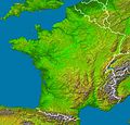
File:France radar 2.jpg
Appearance

Size of this preview: 628 × 600 pixels. Other resolutions: 251 × 240 pixels | 503 × 480 pixels | 804 × 768 pixels | 1,072 × 1,024 pixels | 2,172 × 2,074 pixels.
Original file (2,172 × 2,074 pixels, file size: 3.13 MB, MIME type: image/jpeg)
File history
Click on a date/time to view the file as it appeared at that time.
| Date/Time | Thumbnail | Dimensions | User | Comment | |
|---|---|---|---|---|---|
| current | 04:23, 23 February 2006 |  | 2,172 × 2,074 (3.13 MB) | Sting | '''en :''' * '''Subject :''' France viewed by NASA Shuttle radar-imaging ; * '''Source :''' [http://earthobservatory.nasa.gov/Newsroom/NewImages/images.php3?img_id=15360 NASA Earth Observatory] (modified) ; * '''Original image in Wikipedia :''' [[:Image: |
File usage
The following page uses this file:
Global file usage
The following other wikis use this file:
- Usage on de.wikipedia.org
- Usage on de.wikinews.org
- Usage on eo.wikipedia.org
- Usage on es.wikipedia.org
- Usage on frp.wikipedia.org
- Usage on fr.wikipedia.org
- Région naturelle de France
- Discussion:Région naturelle de France
- Utilisateur:Bludwarf
- Utilisateur:Chauki
- Utilisateur:Wikisoft*/Frageoloc
- Utilisateur:Wikisoft*/Paris
- Utilisateur:Wikisoft*/Cartes
- Utilisateur:Wikisoft*/Tests cartes 1
- Discussion utilisateur:Wikisoft*/Tests cartes 1
- Discussion utilisateur:TomKr/Cartographie
- Utilisateur:Wikisoft*/Géobox-Montagnes-France
- Garrigues (région naturelle)
- Usage on is.wikipedia.org
- Usage on wuu.wikipedia.org
- Usage on zh.wikipedia.org


