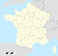
File:France location map-Departements 1997-2014.svg
Appearance

Size of this PNG preview of this SVG file: 624 × 600 pixels. Other resolutions: 250 × 240 pixels | 499 × 480 pixels | 799 × 768 pixels | 1,066 × 1,024 pixels | 2,131 × 2,048 pixels | 2,000 × 1,922 pixels.
Original file (SVG file, nominally 2,000 × 1,922 pixels, file size: 783 KB)
File history
Click on a date/time to view the file as it appeared at that time.
| Date/Time | Thumbnail | Dimensions | User | Comment | |
|---|---|---|---|---|---|
| current | 13:53, 19 October 2017 |  | 2,000 × 1,922 (783 KB) | Sting | No borders over the Lake of Constance |
| 13:19, 7 November 2008 |  | 2,000 × 1,922 (784 KB) | Sting | + boundary for Channel Islands | |
| 16:37, 23 August 2008 |  | 2,000 × 1,922 (782 KB) | Sting | Larger strokes for boundaries | |
| 17:53, 25 July 2008 |  | 2,000 × 1,922 (782 KB) | Sting | Variable scale | |
| 14:38, 25 July 2008 |  | 2,000 × 1,922 (785 KB) | Sting | Other countries' color ; - border | |
| 20:26, 4 July 2008 |  | 2,000 × 1,922 (785 KB) | Sting | == Summary == {{Location|46|15|00|N|02|06|00|E|scale:10000000}} <br/> {{Information |Description={{en|Blank administrative map of France for geo-location purpose, with departements.<br/>Approximate scale : 1:3,000,000}} {{fr|Carte administr |
File usage
No pages on the English Wikipedia use this file (pages on other projects are not listed).
Global file usage
The following other wikis use this file:
- Usage on fr.wikipedia.org
- Usage on fr.wikinews.org
- Usage on pt.wikipedia.org


