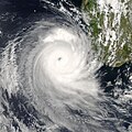
File:Favio 2007-02-20 1115Z.jpg
Appearance

Size of this preview: 471 × 599 pixels. Other resolutions: 188 × 240 pixels | 377 × 480 pixels | 603 × 768 pixels | 804 × 1,024 pixels | 1,609 × 2,048 pixels | 4,400 × 5,600 pixels.
Original file (4,400 × 5,600 pixels, file size: 4.35 MB, MIME type: image/jpeg)
File history
Click on a date/time to view the file as it appeared at that time.
| Date/Time | Thumbnail | Dimensions | User | Comment | |
|---|---|---|---|---|---|
| current | 20:58, 7 September 2007 |  | 4,400 × 5,600 (4.35 MB) | Good kitty | Reverted to version as of 22:40, 20 February 2007 |
| 13:46, 23 February 2007 |  | 3,400 × 3,399 (1.96 MB) | NSLE-Chacor | cropped version | |
| 22:40, 20 February 2007 |  | 4,400 × 5,600 (4.35 MB) | Good kitty | == Summary == {{Information |Description=Tropical Cyclone Favio formed in the western Indian Ocean about 1,200 kilometers from Madagascar on February 14, 2007. It gradually moved southwest, passing well offshore of Reunion and Mauritius Islands. By Februa |
File usage
The following 37 pages use this file:
- 2006–07 South-West Indian Ocean cyclone season
- Cyclone Favio
- Tropical cyclones in 2007
- User:Bob rulz/Hurricane Herald
- User:Fishhead/Archive1
- User:WindRunner/WPTC newsletters
- User talk:@pple/Archive 1
- User talk:A7x/Archive 03
- User talk:Ajm81/Newsletters
- User talk:AstroHurricane001/Archive 6
- User talk:AySz88
- User talk:Cyclone1
- User talk:Daniel/Archive/27
- User talk:Erebus555/archive4
- User talk:Ev-Man
- User talk:Fableheroesguild
- User talk:Hurricane-Inu
- User talk:Hurricanehink/Archive 10
- User talk:Icelandic Hurricane/Recent Archive
- User talk:IrfanFaiz/Archive/Archive No.2
- User talk:Jamie C/Archive 3
- User talk:Juan andrés
- User talk:Maverick423
- User talk:Mkieper
- User talk:Nightstallion/κ
- User talk:Pobbie Rarr
- User talk:Robomaeyhem/Archive 4
- User talk:Sarsaparilla39/Archive 1
- User talk:Sd31415/March 2007
- User talk:Sean Whitton/Archive 10
- User talk:The Grid/Archive 2
- User talk:Titoxd/Archive22
- User talk:Typhoonchaser/Archive 1
- User talk:Verrai/Archive11/Archive9
- User talk:WeatherVane
- User talk:WmE
- Wikipedia:WikiProject Tropical cyclones/Newsletter/Archive 10
Global file usage
The following other wikis use this file:
- Usage on de.wikipedia.org
- Usage on fr.wikipedia.org
- Usage on pt.wikipedia.org
- Usage on zh.wikipedia.org


