
File:FEMA Waffle House Index - 13 February 2014.jpg

Size of this preview: 796 × 600 pixels. Other resolutions: 319 × 240 pixels | 637 × 480 pixels | 1,020 × 768 pixels | 1,171 × 882 pixels.
Original file (1,171 × 882 pixels, file size: 279 KB, MIME type: image/jpeg)
| This is a file from the Wikimedia Commons. Information from its description page there is shown below. Commons is a freely licensed media file repository. You can help. |
Summary
| Description |
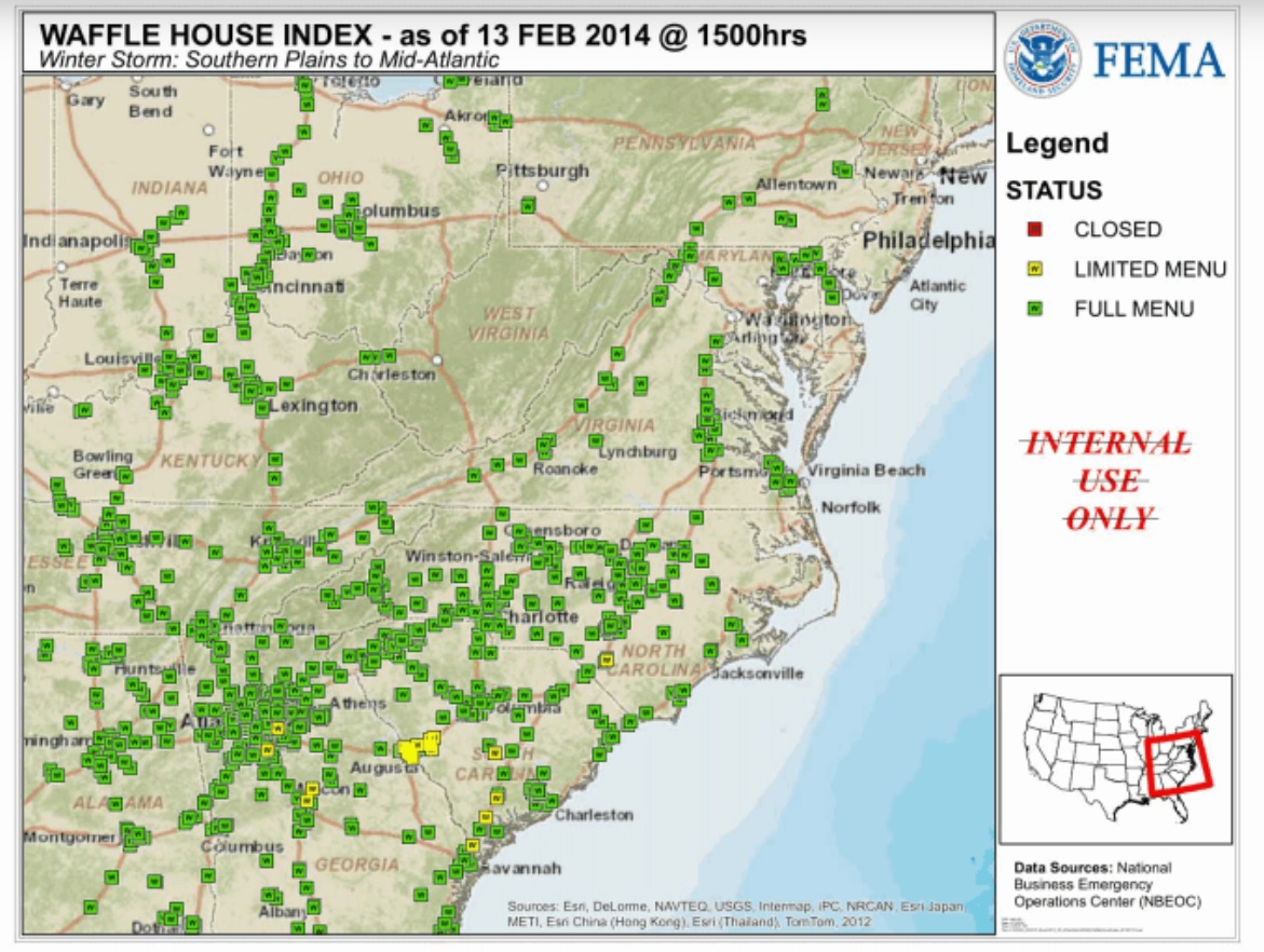
English: A map showing the Waffle House Index, prepared by an employee of FEMA. The map shows all locations of Waffle House restaurants, color-coded by whether they are operating normally, with a limited menu, or closed entirely. The map shows a handful of locations in Georgia and South Carolina serving a limited menu, due to the February 2014 nor'easter |
| Date | |
| Source | https://cdn.muckrock.com/news_photos/2017/09/01/wafflemap_FTg8lI7.jpg |
| Author | Federal Emergency Management Agency |
Licensing
This image is a work of a Federal Emergency Management Agency employee, taken or made as part of that person's official duties. As works of the U.S. federal government, all FEMA images are in the public domain in the United States. Additional media usage information may be found at https://www.fema.gov/photo-video-audio-use-guidelines
|
File history
Click on a date/time to view the file as it appeared at that time.
| Date/Time | Thumbnail | Dimensions | User | Comment | |
|---|---|---|---|---|---|
| current | 08:39, 10 October 2024 | | 1,171 × 882 (279 KB) | Ich | Uploaded own work with UploadWizard |
File usage
The following 2 pages use this file: