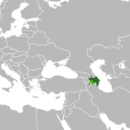
File:Europe Location Azerbaijan uncontrolled and disputed territories highlighted.svg
Appearance

Size of this PNG preview of this SVG file: 600 × 600 pixels. Other resolutions: 240 × 240 pixels | 480 × 480 pixels | 768 × 768 pixels | 1,024 × 1,024 pixels | 2,048 × 2,048 pixels.
Original file (SVG file, nominally 1,024 × 1,024 pixels, file size: 641 KB)
File history
Click on a date/time to view the file as it appeared at that time.
| Date/Time | Thumbnail | Dimensions | User | Comment | |
|---|---|---|---|---|---|
| current | 01:32, 31 May 2010 |  | 1,024 × 1,024 (641 KB) | Dinamik | Artshvashen, Barhkudarly, Kyarki, Verhknaya Askipara:standart colors |
| 17:21, 26 May 2010 |  | 1,024 × 1,024 (615 KB) | Maphobbyist | Reverted to version as of 17:00, 20 January 2010 | |
| 21:04, 28 January 2010 |  | 1,024 × 1,024 (641 KB) | Dinamik | Artshvashen, Barhkudarly, Kyarki, Verhknaya Askipara | |
| 17:27, 23 January 2010 |  | 1,024 × 1,024 (617 KB) | Dinamik | clean up | |
| 17:01, 23 January 2010 |  | 1,024 × 1,024 (617 KB) | Dinamik | standart colors | |
| 17:00, 20 January 2010 |  | 1,024 × 1,024 (615 KB) | Dinamik | == {{int:filedesc}} == {{Information |Description= {{ru|Расположение Азербайджана в Европе. Территории, контролируемые [[:ru:Нагорно-Кара |
File usage
No pages on the English Wikipedia use this file (pages on other projects are not listed).
Global file usage
The following other wikis use this file:
- Usage on hy.wikipedia.org
- Usage on sh.wikipedia.org
