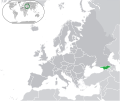
File:Europe-Georgia.svg
Appearance

Size of this PNG preview of this SVG file: 713 × 600 pixels. Other resolutions: 285 × 240 pixels | 571 × 480 pixels | 913 × 768 pixels | 1,218 × 1,024 pixels | 2,435 × 2,048 pixels | 2,045 × 1,720 pixels.
Original file (SVG file, nominally 2,045 × 1,720 pixels, file size: 2.7 MB)
File history
Click on a date/time to view the file as it appeared at that time.
| Date/Time | Thumbnail | Dimensions | User | Comment | |
|---|---|---|---|---|---|
| current | 13:47, 17 December 2023 |  | 2,045 × 1,720 (2.7 MB) | Iktsokh | Cyprus geographically in Asia |
| 20:49, 19 August 2016 |  | 2,045 × 1,720 (2.7 MB) | Crushedkop | Reverted to version as of 05:10, 20 July 2016 (UTC) You will be reported if you continue to disrupt the file. | |
| 23:38, 27 July 2016 |  | 2,045 × 1,720 (2.69 MB) | Damianmx | rv. myself, wrong file | |
| 23:11, 27 July 2016 |  | 2,045 × 1,720 (2.69 MB) | Damianmx | rv overwrite. there's already a separate entry for that version | |
| 05:10, 20 July 2016 |  | 2,045 × 1,720 (2.7 MB) | Crushedkop | Stop POV pushing and respect the original version of the map. | |
| 01:02, 3 May 2016 |  | 2,045 × 1,720 (2.69 MB) | Damianmx | back to stable version | |
| 04:15, 27 November 2014 |  | 2,045 × 1,720 (2.7 MB) | Leftcry | Reverted to version as of 08:47, 8 June 2014 That is because the azerbaijan map hasn't reached a consensus, breakaway regions are important to include | |
| 12:39, 21 November 2014 |  | 2,045 × 1,720 (2.69 MB) | Giorgi Balakhadze | Example from File:Europe-Azerbaijan.svg | |
| 08:47, 8 June 2014 |  | 2,045 × 1,720 (2.7 MB) | Dag13 | revert to original version File:Europe-Russia.svg hasnt explain second colour and File:Europe-Serbia.svg to. | |
| 07:20, 21 May 2014 |  | 2,045 × 1,720 (2.72 MB) | Giorgi Balakhadze | Map doesn't explain what is light-greened. Reverted to version as of 00:10, 2 July 2013 |
File usage
The following 2 pages use this file:
Global file usage
The following other wikis use this file:
- Usage on ar.wikipedia.org
- Usage on az.wikipedia.org
- Usage on bg.wikipedia.org
- Usage on bh.wikipedia.org
- Usage on bi.wikipedia.org
- Usage on bn.wikipedia.org
- Usage on ca.wikipedia.org
- Usage on cs.wikipedia.org
- Usage on da.wikipedia.org
- Usage on es.wikipedia.org
- Usage on fa.wikipedia.org
- Usage on ff.wikipedia.org
- Usage on fr.wikipedia.org
- Usage on gcr.wikipedia.org
- Usage on he.wikipedia.org
- Usage on hi.wikipedia.org
- Usage on incubator.wikimedia.org
- Usage on inh.wikipedia.org
- Usage on it.wikipedia.org
- Usage on ja.wikipedia.org
- Usage on kg.wikipedia.org
- Usage on km.wikipedia.org
- Usage on mk.wikipedia.org
- Usage on ml.wikipedia.org
- Usage on mn.wikipedia.org
- Usage on my.wikipedia.org
- Usage on nl.wikipedia.org
- Usage on nl.wiktionary.org
View more global usage of this file.

