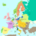
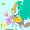
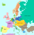
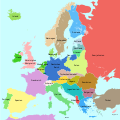
File:Europa 1721.svg
Appearance

Size of this PNG preview of this SVG file: 600 × 600 pixels. Other resolutions: 240 × 240 pixels | 480 × 480 pixels | 768 × 768 pixels | 1,024 × 1,024 pixels | 2,048 × 2,048 pixels | 1,357 × 1,357 pixels.
Original file (SVG file, nominally 1,357 × 1,357 pixels, file size: 680 KB)
File history
Click on a date/time to view the file as it appeared at that time.
| Date/Time | Thumbnail | Dimensions | User | Comment | |
|---|---|---|---|---|---|
| current | 18:16, 17 September 2023 |  | 1,357 × 1,357 (680 KB) | Lalpino | File uploaded using svgtranslate tool (https://svgtranslate.toolforge.org/). Added translation for ca. |
| 11:50, 20 October 2016 |  | 1,357 × 1,357 (667 KB) | Furfur | ... erneut | |
| 11:48, 20 October 2016 |  | 1,357 × 1,357 (667 KB) | Furfur | rechte Bildgrenze, Grenze in Karelien | |
| 11:03, 20 October 2016 |  | 1,387 × 1,367 (667 KB) | Furfur | Details | |
| 22:06, 16 October 2016 |  | 1,387 × 1,367 (666 KB) | Furfur | Details (Oldenburg, Toskana) | |
| 19:53, 1 October 2016 |  | 1,387 × 1,367 (666 KB) | Furfur | hellere Meeresfarbe | |
| 19:12, 1 October 2016 |  | 1,387 × 1,367 (666 KB) | Furfur | nochmal Detail | |
| 19:11, 1 October 2016 |  | 1,387 × 1,367 (666 KB) | Furfur | Details | |
| 19:04, 1 October 2016 |  | 1,387 × 1,367 (666 KB) | Furfur | == {{int:filedesc}} == {{Information |Description={{User:Medium69/Traduction}} {{de|1=Eine einfache Karte von Europa am Ende des Großen Nordischen Krieges 1721.}} {{en|1=A simple map showing Europe at the end of the Great Nordic War, 1721}} |Source={{... |
File usage
The following 4 pages use this file:
Global file usage
The following other wikis use this file:
- Usage on af.wikipedia.org
- Usage on bg.wikipedia.org
- Usage on ca.wikipedia.org
- Usage on sh.wikipedia.org
- Usage on zh-yue.wikipedia.org


