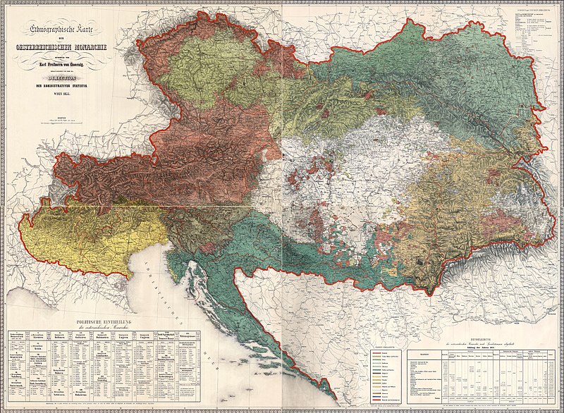
File:Ethnographic map of austrian monarchy czoernig 1855.jpg
Appearance

Size of this preview: 800 × 586 pixels. Other resolutions: 320 × 235 pixels | 640 × 469 pixels | 1,024 × 751 pixels | 1,280 × 938 pixels | 2,560 × 1,877 pixels | 7,997 × 5,862 pixels.
Original file (7,997 × 5,862 pixels, file size: 23.73 MB, MIME type: image/jpeg)
File history
Click on a date/time to view the file as it appeared at that time.
| Date/Time | Thumbnail | Dimensions | User | Comment | |
|---|---|---|---|---|---|
| current | 04:14, 15 June 2016 |  | 7,997 × 5,862 (23.73 MB) | SamuelHrmel | Color revision. |
| 13:06, 21 March 2012 |  | 7,997 × 5,862 (21.11 MB) | WikiEditor2004 | {{Information |Description ={{en|1=Etnographic map of the Austrian Monarchy from 1855, made by Karl Freiherrn von Czoernig.}} |Source =taken from this source: http://www.omm1910.hu/?/en/emaps |Author =Karl Freiherrn von Czoernig |Dat... |
File usage
The following 12 pages use this file:
- Austrian Empire
- Friuli
- History of Transylvania
- Julian March
- Kingdom of Lombardy–Venetia
- Kreis (Habsburg monarchy)
- Slovak lands
- Talk:Austrian Empire/Archive 1
- User:Falcaorib/Austria-Hungary
- Wikipedia:Featured picture candidates/File:Ethnographic map of austrian monarchy czoernig 1855.jpg
- Wikipedia:Featured picture candidates/May-2020
- File talk:Ethnographic map of austrian monarchy czoernig 1855.jpg
Global file usage
The following other wikis use this file:
- Usage on azb.wikipedia.org
- Usage on be-tarask.wikipedia.org
- Usage on cs.wikipedia.org
- Usage on de.wikipedia.org
- Usage on el.wikipedia.org
- Usage on es.wikipedia.org
- Usage on et.wikipedia.org
- Usage on fi.wikipedia.org
- Usage on fr.wikipedia.org
- Usage on gl.wikipedia.org
- Usage on hr.wikipedia.org
- Usage on hu.wikipedia.org
- Usage on id.wikipedia.org
- Wikipedia:Gambar pilihan/Usulan/2022
- Wikipedia:Gambar pilihan/Usulan/2022/Periode 16
- Wikipedia:Gambar pilihan/2022
- Wikipedia:Gambar pilihan/64 2022
- Wikipedia:Arsip halaman utama/2022/09/10
- Wikipedia:Arsip halaman utama/2022/09/11
- Wikipedia:Arsip halaman utama/2022/09/12
- Wikipedia:Arsip halaman utama/2022/09/13
- Usage on it.wikipedia.org
- Usage on ja.wikipedia.org
- Usage on ka.wikipedia.org
- Usage on mk.wikipedia.org
- Usage on pl.wikipedia.org
- Usage on sh.wikipedia.org
View more global usage of this file.

