Jump to content

File:Establishing El Gouna (2014).jpeg

Page contents not supported in other languages.
This is a file from the Wikimedia Commons
From Wikipedia, the free encyclopedia

Original file (1,362 × 1,362 pixels, file size: 622 KB, MIME type: image/jpeg)

Summary

Description

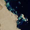
In 1985, sand and coral dominated the Red Sea coast in an area about 30 kilometers (19 miles) northwest of Hurghada, Egypt. Aside from a lone road that ran along the coast, the desert landscape was largely untouched by human activity. Three decades later, development has radically reshaped the coastline.

The construction of El Gouna, a resort town, began in 1989. Building proceeded in waves, with a small cluster of summer holiday homes eventually morphing into a year-round community of about 23,000 people. As of 2015, El Gouna included 16 hotels, some 2,700 villas, 3 marinas, an 18-hole golf course, and hundreds of restaurants and shops.

Developers were not content to simply build on the existing landscape. To give seaside views and easy access to the water to as many El Gouna residents and guests as possible, builders dredged huge amounts of sand from coastal bays and inlets to sculpt the canals, marinas, hotels, and artificial islands of the resort.

The changes to the coast are evident in this pair of natural-color images acquired by sensors on Landsat satellites. The top image was captured by the Thematic Mapper (TM) on Landsat 5 in 1985; the bottom image was captured by the Operational Land Imager (OLI) on Landsat 8 in 2014.

While El Gouna has pledged to become a carbon neutral town, the resort has come with a cost for the local environment, particularly the coral reef ecosystems that make the area so appealing. Construction of coastal hotels and other infrastructure often involved the destruction of fringing reefs along the coastlines, caused by the dredging or dumping of large amounts of sediment.

While it is difficult to distinguish between reefs, underwater sand, sea grass, and algae in natural-color Landsat imagery, some scientists have used other wavelengths to track changes in corals near El Gouna and neighboring Hurghada. The findings indicate the reefs may be in trouble. According to one study, corals near Hurghada have declined by as much as 50 percent over three decades.
Date
Source https://earthobservatory.nasa.gov/images/86444/establishing-el-gouna
Author NASA Earth Observatory images by Jesse Allen and Adam Voiland, using Landsat data from the U.S. Geological Survey. Caption by Adam Voiland.

Licensing

Public domain This file is in the public domain in the United States because it was solely created by NASA. NASA copyright policy states that "NASA material is not protected by copyright unless noted". (See Template:PD-USGov, NASA copyright policy page or JPL Image Use Policy.)
Warnings:

Captions

Add a one-line explanation of what this file represents

Items portrayed in this file

depicts

636,590 byte

1,362 pixel

1,362 pixel

image/jpeg

6e736551eae14bf48ac1f30035b6613fa2dc293d

File history

Click on a date/time to view the file as it appeared at that time.

Date/TimeThumbnailDimensionsUserComment
current05:34, 12 March 2021Thumbnail for version as of 05:34, 12 March 20211,362 × 1,362 (622 KB)StellarHalo{{Information |Description=In 1985, sand and coral dominated the Red Sea coast in an area about 30 kilometers (19 miles) northwest of Hurghada, Egypt. Aside from a lone road that ran along the coast, the desert landscape was largely untouched by human activity. Three decades later, development has radically reshaped the coastline. The construction of El Gouna, a resort town, began in 1989. Building proceeded in waves, with a small cluster of summer holiday homes eventually morphing into a ye...

The following page uses this file:

Global file usage

The following other wikis use this file:

Metadata