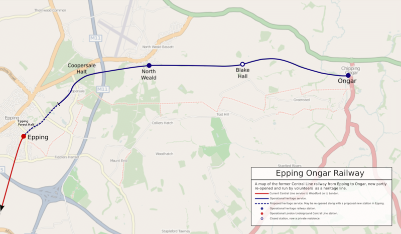
File:Epping Ongar Railway map.png
Appearance

Size of this preview: 800 × 467 pixels. Other resolutions: 320 × 187 pixels | 640 × 374 pixels | 1,024 × 598 pixels | 1,280 × 748 pixels | 2,560 × 1,496 pixels | 3,550 × 2,074 pixels.
Original file (3,550 × 2,074 pixels, file size: 7.03 MB, MIME type: image/png)
File history
Click on a date/time to view the file as it appeared at that time.
| Date/Time | Thumbnail | Dimensions | User | Comment | |
|---|---|---|---|---|---|
| current | 23:54, 16 May 2018 |  | 3,550 × 2,074 (7.03 MB) | RaviC | + Epping Forest |
| 20:00, 20 October 2012 |  | 3,550 × 2,074 (7.98 MB) | Sunil060902 | Updated to show extent of summer 2012 extension from Coopersale. | |
| 05:21, 30 September 2007 |  | 3,550 × 2,074 (2.96 MB) | Collard | {{Information |Description=Map of the Epping Ongar Railway. |Source=[http://www.openstreetmap.org/index.html?lat=51.71&lon=0.18&zoom=13 Material on OpenStreetMap.org] and myself. |Date=2007-09-30 |Author=Portions copyright © [[User:Collard|Lewis Coll |
File usage
The following 2 pages use this file:
Global file usage
The following other wikis use this file:
- Usage on de.wikipedia.org
- Usage on pl.wikipedia.org
- Usage on ru.wikipedia.org
- Usage on simple.wikipedia.org
- Usage on www.wikidata.org

