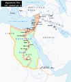
File:Egypt 1450 BC.svg
Appearance

Size of this PNG preview of this SVG file: 520 × 600 pixels. Other resolutions: 208 × 240 pixels | 416 × 480 pixels | 666 × 768 pixels | 887 × 1,024 pixels | 1,775 × 2,048 pixels | 1,300 × 1,500 pixels.
Original file (SVG file, nominally 1,300 × 1,500 pixels, file size: 257 KB)
File history
Click on a date/time to view the file as it appeared at that time.
| Date/Time | Thumbnail | Dimensions | User | Comment | |
|---|---|---|---|---|---|
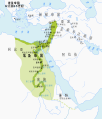
| current | 22:18, 23 September 2023 |  | 1,300 × 1,500 (257 KB) | Gaaryeelidmaan | Punt was associated with Myrrh trade, a product found in modern Puntland https://www.worldhistory.org/punt/ |
| 05:28, 9 October 2013 |  | 1,300 × 1,500 (257 KB) | Lymantria | Reverted to version as of 00:24, 10 August 2008 | |
| 16:05, 7 October 2013 |  | 1,300 × 1,500 (238 KB) | Emara | تعريب الخريطة | |
| 00:24, 10 August 2008 |  | 1,300 × 1,500 (257 KB) | Leoboudv | {{Information |Description=Map of the Middle East 1450 BC |Source=The original description page is/was [http://en.wikipedia.org/w/index.php?title=Image%3AEgypt_1450_BC.svg here]. All following user names refer to en.wikipedia. * 2008-05-07 09:18 [[:en:Use |
File usage
The following 12 pages use this file:
- Land of Punt
- List of conflicts in Asia
- List of conflicts in Libya
- List of conflicts in Sudan
- Middle Eastern empires
- The Bible Unearthed
- Thutmose I
- Timeline of Jerusalem
- Transjordan (region)
- Talk:The Exodus/Archive 18
- User:Falcaorib/Ancient Empires (4000-550 BC)
- User:SomeGuyWhoRandomlyEdits/List of conflicts in the Near East
Global file usage
The following other wikis use this file:
- Usage on ast.wikipedia.org
- Usage on azb.wikipedia.org
- Usage on az.wikipedia.org
- Usage on ba.wikipedia.org
- Usage on be.wikipedia.org
- Usage on bg.wikipedia.org
- Usage on bn.wikipedia.org
- Usage on ca.wikipedia.org
- Usage on cv.wikipedia.org
- Usage on de.wikipedia.org
- Usage on el.wikipedia.org
- Usage on eu.wikipedia.org
- Usage on fa.wikipedia.org
- Usage on gl.wikipedia.org
- Usage on ha.wikipedia.org
- Usage on hi.wikipedia.org
- Usage on hy.wikipedia.org
- Usage on hyw.wikipedia.org
- Usage on id.wikipedia.org
- Usage on id.wikibooks.org
- Usage on is.wikipedia.org
- Usage on it.wikipedia.org
- Usage on ja.wikipedia.org
- Usage on ka.wikipedia.org
- Usage on la.wikipedia.org
- Usage on lt.wikipedia.org
- Usage on mg.wikipedia.org
- Usage on mr.wikipedia.org
- Usage on ms.wikipedia.org
- Usage on no.wikipedia.org
- Usage on pl.wikipedia.org
- Usage on pnb.wikipedia.org
View more global usage of this file.


