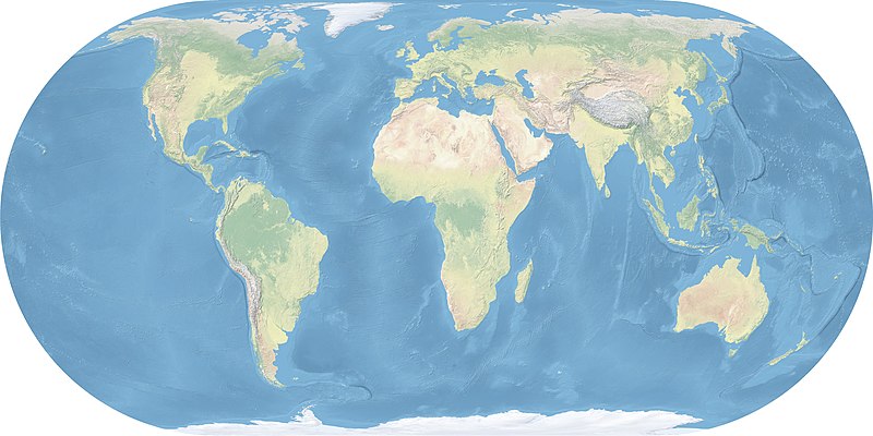
File:Eckert4.jpg
Appearance

Size of this preview: 800 × 400 pixels. Other resolutions: 320 × 160 pixels | 640 × 320 pixels | 1,024 × 512 pixels | 1,280 × 640 pixels | 2,560 × 1,280 pixels | 5,400 × 2,700 pixels.
Original file (5,400 × 2,700 pixels, file size: 1.56 MB, MIME type: image/jpeg)
File history
Click on a date/time to view the file as it appeared at that time.
| Date/Time | Thumbnail | Dimensions | User | Comment | |
|---|---|---|---|---|---|
| current | 15:04, 4 May 2017 |  | 5,400 × 2,700 (1.56 MB) | ديفيد عادل وهبة خليل 2 | Reverted to version as of 18:06, 29 October 2011 (UTC) |
| 13:44, 2 May 2017 |  | 2,448 × 2,080 (1.22 MB) | FahdAbiRashed | طريق الحرير الجديد | |
| 18:06, 29 October 2011 |  | 5,400 × 2,700 (1.56 MB) | Ktrinko | {{Information |Description ={{en|1=world map made with natural earth data, eckert 4 projection, central meridian 10 ° east}} {{de|1=Weltkarte erstellt mit Natural Earth Daten, Eckert 4 Projektion, zentraler Meridian 10 ° Ost}} |Source ={{own} |
File usage
The following 2 pages use this file:
Global file usage
The following other wikis use this file:
- Usage on cs.wikipedia.org
- Usage on da.wikipedia.org
- Usage on es.wikipedia.org
- Usage on es.wikiversity.org
- Usage on fr.wikipedia.org
- Usage on he.wikivoyage.org
- Usage on jv.wikipedia.org
- Usage on lv.wikipedia.org
- Usage on tr.wikipedia.org
- Usage on zh.wikipedia.org
