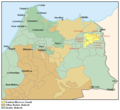
File:Eastern Morocco Zenati map.PNG
Appearance

Size of this preview: 656 × 600 pixels. Other resolutions: 263 × 240 pixels | 525 × 480 pixels | 686 × 627 pixels.
Original file (686 × 627 pixels, file size: 46 KB, MIME type: image/png)
File history
Click on a date/time to view the file as it appeared at that time.
| Date/Time | Thumbnail | Dimensions | User | Comment | |
|---|---|---|---|---|---|
| current | 18:41, 12 April 2020 |  | 686 × 627 (46 KB) | Omar-toons | Adjust Targuist, Aït Gmil, Aït Boufrah & Aït Itteft partly Berber-speaking areas acc. to Lafkioui |
| 17:15, 22 June 2016 |  | 686 × 627 (46 KB) | Omar-toons | Corr. Srayr, Zerhoun & Triffa | |
| 06:05, 6 May 2015 |  | 686 × 627 (42 KB) | Omar-toons | min. ch. on Sanhaja d-Srayr acc. to Lafkioui: Berberophones remain among Ketamas, Riffian for N.E. Mezdouy | |
| 05:22, 2 May 2015 |  | 686 × 627 (42 KB) | Omar-toons | User created page with UploadWizard |
File usage
The following page uses this file:
Global file usage
The following other wikis use this file:
- Usage on ar.wikipedia.org
- Usage on ary.wikipedia.org
- Usage on ca.wikipedia.org
- Usage on es.wikipedia.org
- Usage on fr.wikipedia.org
- Usage on www.wikidata.org
