
File:East Pine Street Historic District (2012) - Missoula County, Montana.png

Size of this preview: 800 × 534 pixels. Other resolutions: 320 × 213 pixels | 640 × 427 pixels | 1,024 × 683 pixels | 1,280 × 854 pixels | 1,600 × 1,067 pixels.
Original file (1,600 × 1,067 pixels, file size: 3.55 MB, MIME type: image/png)
| This is a file from the Wikimedia Commons. Information from its description page there is shown below. Commons is a freely licensed media file repository. You can help. |
_-_Missoula_County,_Montana.png)
Summary
| Camera location | | View this and other nearby images on: OpenStreetMap |
|---|
_-_Missoula_County,_Montana.png¶ms=046.871667_N_-113.988333_E_globe:Earth_type:camera__&language=en)
| Description |
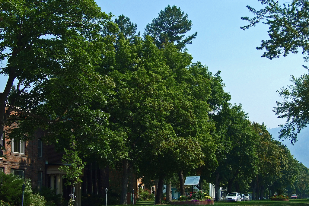
English: East Pine Street Historic DistrictMissoula’s evolution from trading post to railroad center, university town, and federal government hub is revealed in this distinctive downtown residential neighborhood. Francis L. Worden, among Missoula’s most influential early merchants and leaders, built his home here in 1874-1875. Political leader Joseph Dixon built his home in 1891, modifying it through 1921 as he served in the House of Representatives, the U.S. Senate, and as Montana’s governor in 1920. Other early business and civic leaders built large homes at the west end of the district as the arrival of the Northern Pacific in 1883 spurred Missoula’s growth. With the University’s development in the late 1890s and construction of original portions of the Federal Building in 1911, the district attracted construction of apartments and smaller residences. The district’s architecture reflects sixty years of evolution featuring Queen Anne styling with turrets, asymmetrical features, decorative shingles, and the more symmetrical Neo-classical style. East Pine Street, with its boulevard and unique centered medians, is the product of Francis Worden’s imported maple trees and Joseph Dixon’s 1915 petition to the city for creation of a formal boulevard. This landscaped corridor pulls together a slice of Missoula’s early development.
|
||
| Date | |||
| Source | Own work | ||
| Author | Robstutz |
Licensing
I, the copyright holder of this work, hereby publish it under the following license:
This file is licensed under the Creative Commons Attribution-Share Alike 3.0 Unported license.
- You are free:
- to share – to copy, distribute and transmit the work
- to remix – to adapt the work
- Under the following conditions:
- attribution – You must give appropriate credit, provide a link to the license, and indicate if changes were made. You may do so in any reasonable manner, but not in any way that suggests the licensor endorses you or your use.
- share alike – If you remix, transform, or build upon the material, you must distribute your contributions under the same or compatible license as the original.

|
This image was uploaded as part of Wiki Loves Monuments 2012.
|
 |
File history
Click on a date/time to view the file as it appeared at that time.
| Date/Time | Thumbnail | Dimensions | User | Comment | |
|---|---|---|---|---|---|
| current | 22:54, 9 September 2012 | | 1,600 × 1,067 (3.55 MB) | Robstutz | User created page with UploadWizard |
File usage
The following page uses this file:
_-_Missoula_County,_Montana.png)