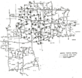
File:ERCS location map.png
Appearance

Size of this preview: 636 × 599 pixels. Other resolutions: 255 × 240 pixels | 510 × 480 pixels | 815 × 768 pixels | 1,087 × 1,024 pixels | 1,553 × 1,463 pixels.
Original file (1,553 × 1,463 pixels, file size: 978 KB, MIME type: image/png)
File history
Click on a date/time to view the file as it appeared at that time.
| Date/Time | Thumbnail | Dimensions | User | Comment | |
|---|---|---|---|---|---|
| current | 23:57, 11 August 2012 |  | 1,553 × 1,463 (978 KB) | Tdrss | Cropped off the classification markings; the document was declassified by Air Force Global Strike Command, circa 2012. |
| 23:53, 11 August 2012 |  | 2,181 × 1,700 (1.17 MB) | Tdrss | {{Information |Description=Location map of Emergency Rocket Communication System sorties at Whiteman AFB, Missouri |Source=351st Strategic Missile Wing history, 1992 |Date=1992 |Author=351st Operations Group |Permission=Open Source due to creation by U... |
File usage
The following page uses this file:
Global file usage
The following other wikis use this file:
- Usage on nn.wikipedia.org
- Usage on no.wikipedia.org

