File:EPAmap.jpg
Appearance

Size of this preview: 512 × 599 pixels. Other resolutions: 205 × 240 pixels | 410 × 480 pixels | 790 × 925 pixels.
Original file (790 × 925 pixels, file size: 90 KB, MIME type: image/jpeg)
File history
Click on a date/time to view the file as it appeared at that time.
| Date/Time | Thumbnail | Dimensions | User | Comment | |
|---|---|---|---|---|---|
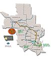
| current | 05:43, 21 October 2009 |  | 790 × 925 (90 KB) | Matthewdunkle | {{Information |Description={{en|1=Map of the Clark Fork River Operable Unit, USEPA.}} |Source=http://www.epa.gov/region8/superfund/mt/milltowncfr/cfr/ |Author=USEPA |Date=2009-07-7 |Permission={{PD-USGov-EPA}} |other_versions= }} |
File usage
The following page uses this file:


