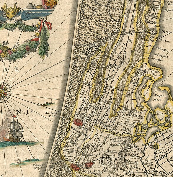
File:Duin-en Bollenstreek - map - 1645.JPG

Original file (902 × 923 pixels, file size: 590 KB, MIME type: image/jpeg)
Summary
[edit]Part of a map entitled Rhenolandiæ Amstellandiæ exactissima tabula from "Theatrum Orbis Terrarum, sive Atlas Novus in quo Tabulæ et Descriptiones Omnium Regionum, Editæ a Guiljel et Ioanne Blaeu" (Theater of the World, or a New Atlas of Maps and Representations of All Regions, Edited by Willem and Joan Blaeu), 1645.
Licensing:
[edit]| This image is in the public domain because under the Copyright law of the United States, originality of expression is necessary for copyright protection, and a mere photograph of an out-of-copyright two-dimensional work may not be protected under American copyright law. The official position of the Wikimedia Foundation is that all reproductions of public domain works should be considered to be in the public domain regardless of their country of origin (even in countries where mere labor is enough to make a reproduction eligible for protection). | ||||
| ||||
 | This file is a candidate to be copied to Wikimedia Commons.
Any user may perform this transfer; refer to Wikipedia:Moving files to Commons for details. If this file has problems with attribution, copyright, or is otherwise ineligible for Commons, then remove this tag and DO NOT transfer it; repeat violators may be blocked from editing. Other Instructions
| ||
| |||
File history
Click on a date/time to view the file as it appeared at that time.
| Date/Time | Thumbnail | Dimensions | User | Comment | |
|---|---|---|---|---|---|
| current | 11:21, 14 March 2008 |  | 902 × 923 (590 KB) | Schildewaert (talk | contribs) | Part of a map entitled Rhenolandiæ Amstellandiæ exactissima tabula from "Theatrum Orbis Terrarum, sive Atlas Novus in quo Tabulæ et Descriptiones Omnium Regionum, Editæ a Guiljel et Ioanne Blaeu" (Theater of the World, or a New Atlas of Maps and Repre |
You cannot overwrite this file.
File usage
The following page uses this file:
