
File:Dobroger.png
No higher resolution available.
Dobroger.png (657 × 565 pixels, file size: 71 KB, MIME type: image/png)
| This is a file from the Wikimedia Commons. Information from its description page there is shown below. Commons is a freely licensed media file repository. You can help. |

|
This map has been uploaded by Electionworld from en.wikipedia.org to enable the |
Summary
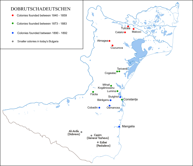
Places were Dobruja Germans have founded colonies. Made by me.
Licensing
This file is licensed under the Creative Commons Attribution 2.5 Generic license.
- You are free:
- to share – to copy, distribute and transmit the work
- to remix – to adapt the work
- Under the following conditions:
- attribution – You must give appropriate credit, provide a link to the license, and indicate if changes were made. You may do so in any reasonable manner, but not in any way that suggests the licensor endorses you or your use.
File history
Click on a date/time to view the file as it appeared at that time.
| Date/Time | Thumbnail | Dimensions | User | Comment | |
|---|---|---|---|---|---|
| current | 11:43, 21 March 2009 | | 657 × 565 (71 KB) | TodorBozhinov | added colonies in Bulgaria, data from 1930 Romanian census (236 in Casim, 169 in Ezibei, and the best-known colony Ali-Anife founded in 1903) |
| 11:43, 21 March 2009 |  | 1,680 × 1,050 (94 KB) | TodorBozhinov | added colonies in Bulgaria, data from 1930 Romanian census (236 in Casim, 169 in Ezibei, and the best-known colony Ali-Anife founded in 1903) | |
| 22:30, 20 December 2006 |  | 657 × 565 (26 KB) | Electionworld | {{ew|en|Anonimu}} == Summary == Places were Dobruja Germans have founded colonies. Made by me. == Licensing == {{cc-by-2.5}} Category:Maps of the history of Bulgaria Category:Maps of the history of Romania |
File usage
The following 2 pages use this file:
Global file usage
The following other wikis use this file:
- Usage on bg.wikipedia.org
- Usage on de.wikipedia.org
- Usage on es.wikipedia.org
- Usage on id.wikipedia.org
- Usage on it.wikipedia.org
- Usage on ro.wikipedia.org