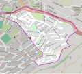
File:Devils Peak Estate OSM map.svg
Appearance

Size of this PNG preview of this SVG file: 670 × 599 pixels. Other resolutions: 269 × 240 pixels | 537 × 480 pixels | 859 × 768 pixels | 1,145 × 1,024 pixels | 2,291 × 2,048 pixels.
Original file (SVG file, nominally 670 × 599 pixels, file size: 1.84 MB)
File history
Click on a date/time to view the file as it appeared at that time.
| Date/Time | Thumbnail | Dimensions | User | Comment | |
|---|---|---|---|---|---|
| current | 13:16, 17 October 2015 |  | 670 × 599 (1.84 MB) | Htonl | {{OpenStreetMap |odbl=yes |location=Devil's Peak Estate |category=|left=18.422 |bottom=-33.9425 |right=18.4355 |top=-33.9325}} Category:OpenStreetMap maps of South Africa Category:Maps of Cape Town suburbs |
File usage
The following page uses this file:

