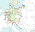
File:Deutschlandlied Karte (deutsch).png
Appearance

Size of this preview: 666 × 599 pixels. Other resolutions: 267 × 240 pixels | 533 × 480 pixels | 853 × 768 pixels | 1,138 × 1,024 pixels | 1,680 × 1,512 pixels.
Original file (1,680 × 1,512 pixels, file size: 389 KB, MIME type: image/png)
File history
Click on a date/time to view the file as it appeared at that time.
| Date/Time | Thumbnail | Dimensions | User | Comment | |
|---|---|---|---|---|---|
| current | 04:33, 18 June 2022 |  | 1,680 × 1,512 (389 KB) | Vlaemink | Fixed Burgenland border |
| 04:15, 18 June 2022 |  | 1,680 × 1,512 (387 KB) | Vlaemink | Corrected position of the Meuse river | |
| 17:18, 16 June 2022 |  | 1,680 × 1,512 (388 KB) | Vlaemink | Changed position of Belt (Little Belt) and colour scheme | |
| 12:25, 15 June 2022 |  | 1,326 × 1,248 (303 KB) | Vlaemink | Uploaded own work with UploadWizard |
File usage
The following 2 pages use this file:
Global file usage
The following other wikis use this file:
- Usage on de.wikipedia.org
- Usage on nl.wikipedia.org
