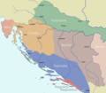
File:Dalmatia Croatia Slavonia Bosnia 1720 Matthaeus Seuteri.png
Appearance

Size of this preview: 688 × 600 pixels. Other resolutions: 275 × 240 pixels | 551 × 480 pixels | 881 × 768 pixels | 1,175 × 1,024 pixels | 2,230 × 1,944 pixels.
Original file (2,230 × 1,944 pixels, file size: 150 KB, MIME type: image/png)
File history
Click on a date/time to view the file as it appeared at that time.
| Date/Time | Thumbnail | Dimensions | User | Comment | |
|---|---|---|---|---|---|
| current | 11:55, 10 January 2021 |  | 2,230 × 1,944 (150 KB) | Mhare | Reverted to version as of 17:25, 29 November 2015 (UTC) no source for changes made, original author made a map according to the map of Matthaeus Seuteri from 1720 - as is. |
| 14:23, 30 March 2018 |  | 2,230 × 1,944 (130 KB) | Ceha | Fixed errors around Brod and Konavle | |
| 00:15, 1 August 2016 |  | 2,230 × 1,944 (130 KB) | Ceha | Istria | |
| 00:12, 1 August 2016 |  | 2,230 × 1,944 (130 KB) | Ceha | Fixed errors in Istria, Pokuplje and Vrbas | |
| 17:25, 29 November 2015 |  | 2,230 × 1,944 (150 KB) | IoannesII | User created page with UploadWizard |
File usage
The following 4 pages use this file:
Global file usage
The following other wikis use this file:
- Usage on el.wikipedia.org
- Usage on es.wikipedia.org
- Usage on fr.wikipedia.org
- Usage on hr.wikipedia.org
- Usage on tr.wikipedia.org
- Usage on uk.wikipedia.org
