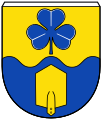
File:DEU Leybuchtpolder COA.svg
Appearance

Size of this PNG preview of this SVG file: 324 × 381 pixels. Other resolutions: 204 × 240 pixels | 408 × 480 pixels | 653 × 768 pixels | 871 × 1,024 pixels | 1,742 × 2,048 pixels.
Original file (SVG file, nominally 324 × 381 pixels, file size: 9 KB)
File history
Click on a date/time to view the file as it appeared at that time.
| Date/Time | Thumbnail | Dimensions | User | Comment | |
|---|---|---|---|---|---|
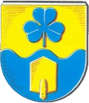
| current | 23:03, 26 February 2022 |  | 324 × 381 (9 KB) | Doc Taxon | {{COAInformation |blazon of = {{de|Leybuchtpolder}} {{en|Leybuchtpolder}} |blazon = {{de|Von Gold und Blau im Wellenschnitt geteilt, oben ein blaues dreiblättriges Kleeblatt, unten ein goldenes Spatenblatt.}} |references = Karl Leiner: ''Panorama Landkreis Norden.'' Norden 1972. p. 209–216. |tincture = o/b/- |description = {{de|Das Gebiet der Gemeinde Leybuchtpolder wurde erst nach dem Zweiten Weltkrieg, nach dem Bau des Störtebekerdeichs, besiedelt. Als Zeichen für... |
File usage
The following page uses this file:
Global file usage
The following other wikis use this file:
- Usage on de.wikipedia.org
- Usage on fa.wikipedia.org
- Usage on fr.wikipedia.org
- Usage on simple.wikipedia.org
- Usage on www.wikidata.org


