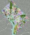
File:DC neighborhoods map high res.png
Appearance

Size of this preview: 526 × 599 pixels. Other resolutions: 211 × 240 pixels | 421 × 480 pixels | 674 × 768 pixels | 899 × 1,024 pixels | 1,798 × 2,048 pixels | 4,390 × 5,000 pixels.
Original file (4,390 × 5,000 pixels, file size: 5.51 MB, MIME type: image/png)
File history
Click on a date/time to view the file as it appeared at that time.
| Date/Time | Thumbnail | Dimensions | User | Comment | |
|---|---|---|---|---|---|
| current | 02:24, 2 September 2011 |  | 4,390 × 5,000 (5.51 MB) | Peterfitzgerald | minor change |
| 02:13, 2 September 2011 |  | 4,390 × 5,000 (5.5 MB) | Peterfitzgerald | Lots of corrections and refinements | |
| 17:00, 6 January 2010 |  | 4,390 × 5,000 (5.4 MB) | Peterfitzgerald | {{Information |Description={{en|1=DC neighborhoods map, high resolution}} |Source=self-made, tracing done from PD satellite imagery |Author=Peterfitzgerald |Date= |Permission=CC-by 3.0 |other_versions=[[:File:DC neighborhoods map. |
File usage
The following page uses this file:
Global file usage
The following other wikis use this file:
- Usage on is.wikipedia.org
- Usage on mn.wikipedia.org
- Usage on mt.wikipedia.org
- Usage on simple.wikipedia.org
- Usage on si.wikipedia.org
- Usage on uk.wikipedia.org
- Usage on www.wikidata.org
