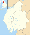
File:Cumbria UK district map 2023 (blank).svg
Appearance

Size of this PNG preview of this SVG file: 508 × 599 pixels. Other resolutions: 203 × 240 pixels | 407 × 480 pixels | 651 × 768 pixels | 868 × 1,024 pixels | 1,736 × 2,048 pixels | 1,140 × 1,345 pixels.
Original file (SVG file, nominally 1,140 × 1,345 pixels, file size: 1.14 MB)
File history
Click on a date/time to view the file as it appeared at that time.
| Date/Time | Thumbnail | Dimensions | User | Comment | |
|---|---|---|---|---|---|
| current | 19:52, 21 March 2022 |  | 1,140 × 1,345 (1.14 MB) | Dr Greg | remove unwanted boundary line |
| 19:27, 2 February 2022 |  | 1,140 × 1,345 (1.25 MB) | Rcsprinter123 | Uploaded own work with UploadWizard |
File usage
The following page uses this file:
Global file usage
The following other wikis use this file:
- Usage on de.wikipedia.org
- Nationalparks im Vereinigten Königreich
- Sellafield
- Endlager Drigg
- Kernkraftwerk Calder Hall
- Mickledore
- Belle Isle (Windermere)
- Windermere
- Ullswater
- Derwent Water
- Bassenthwaite Lake
- Buttermere (See)
- Thirlmere
- Coniston Water
- Wast Water
- Haweswater Reservoir
- Ennerdale Water
- Crummock Water
- Innominate Tarn
- Esthwaite Water
- Loweswater
- Hayeswater
- Rydal Water
- Grizedale Forest
- Brunton Park
- Vorlage:Positionskarte England Cumbria
- Offshore-Windpark Robin Rigg
- Offshore-Windpark Barrow
- Roa Island
- Piel Island
- Hardknott Pass
- Wrynose Pass
- Dunmail Raise
- Grasmere (See)
- Offshore-Windpark Ormonde
- Elter Water
- Kirkstone Pass
- Blea Water
- Small Water
- Kentmere Reservoir
- Cow Green Reservoir
- Grisedale Tarn
- Brothers Water
- Uldale Force
- Cautley Spout
- Blea Tarn (Eskdale)
- Blea Tarn (Watendlath)
- Watendlath Tarn
- Scale Force
- Bleaberry Tarn
- Styhead Tarn
View more global usage of this file.
