Jump to content

File:Croatian Prevlaka in occupation by Montenegro and Serbia.jpg

Page contents not supported in other languages.
This is a file from the Wikimedia Commons
From Wikipedia, the free encyclopedia

Croatian_Prevlaka_in_occupation_by_Montenegro_and_Serbia.jpg (760 × 560 pixels, file size: 118 KB, MIME type: image/jpeg)

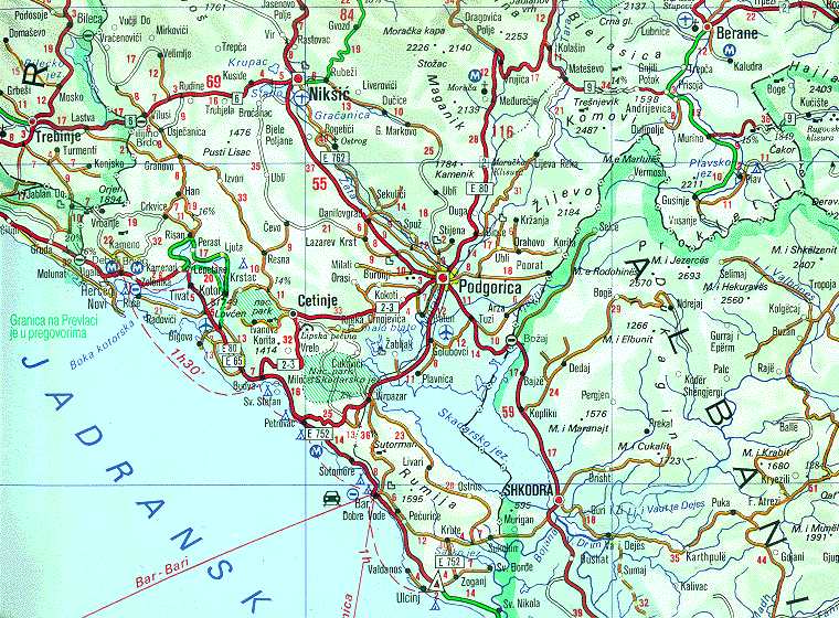
Description Map of Montenegrin Littoral Region and Boka kotorska in the time of occupation of Croatian Prevlaka Region which is the remaining part of Boka kotorska that belongs to Croatia.
Date 1991-2002 (occupation ended 1992-10-20 at 20:30) (UNMIK mission ended 2002-12-20).
Source Ministry of Foreign Affairs of the State Union Serbia and Montenegro (before that MFA of Federal Republic of Yugoslavia
Author Serbian Official Cartography (Public Service at the time).
Permission
(Reusing this file)
Public domain
This image is in the public domain because according to the Copyright Law of Serbia and Montenegro ("Службени гласник СЦГ", бр. 61/2004), "Work is not copyrighted if the work is:
  1. Law, sub-law act or other kind of law act.
  2. Official materials of state authorities or materials published by any other person or institution which do public function.
  3. Official translations of materials of state authorities or translation of materials published by any other person or institution which do public function.
  4. Any of acts in judgment processes."
A source should be included so that the status can be verified. This federal law applies for both republics, Serbia and Montenegro, as long as they do not adopt own inherent laws.

English | македонски | slovenščina | српски / srpski | +/−

Other versions Geographical version.

Captions

Add a one-line explanation of what this file represents

Items portrayed in this file

depicts

image/jpeg

0c8536948e50dc44d974aae9498c6c829d74799f

120,877 byte

560 pixel

760 pixel

File history

Click on a date/time to view the file as it appeared at that time.

Date/TimeThumbnailDimensionsUserComment
current02:05, 16 February 2008Thumbnail for version as of 02:05, 16 February 2008760 × 560 (118 KB)Imbris~commonswiki{{Information |Description=Map of Montenegrin ''Littoral Region'' and ''Boka kotorska'' in the time of occupation of Croatian hr:Prevlaka Region which is the remaining part of Boka kotorska that belongs to Croatia. |Source=[http://www.mfa.gov.yu/Fact

The following page uses this file:

Global file usage

The following other wikis use this file:

Metadata