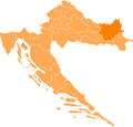
File:CroatiaOsijek-Baranja.png
Appearance

Size of this preview: 627 × 599 pixels. Other resolutions: 251 × 240 pixels | 502 × 480 pixels | 804 × 768 pixels | 1,071 × 1,024 pixels | 1,288 × 1,231 pixels.
Original file (1,288 × 1,231 pixels, file size: 29 KB, MIME type: image/png)
File history
Click on a date/time to view the file as it appeared at that time.
| Date/Time | Thumbnail | Dimensions | User | Comment | |
|---|---|---|---|---|---|
| current | 09:28, 1 May 2011 |  | 1,288 × 1,231 (29 KB) | PrisonerOfIce | |
| 18:27, 10 May 2008 |  | 1,288 × 1,231 (54 KB) | Пакко | {{Information |Description= |Source= |Date= |Author= |Permission= |other_versions= }} | |
| 00:38, 13 April 2006 |  | 200 × 198 (20 KB) | West Virginian | Map showing Osijek-Baranja county within Croatia. {{GFDL}} Category:Maps of Croatia cs:Soubor:CroatiaOsijek-Baranja.png en:Image:CroatiaOsijek-Baranja.png hr:Slika:Osječko-baranjska.png nl:Afbeelding:KroatiëOsijek-Baranja.png |
File usage
The following page uses this file:
Global file usage
The following other wikis use this file:
- Usage on bs.wikipedia.org
- Usage on de.wikipedia.org
- Osijek
- Našice
- Donji Miholjac
- Đakovo
- Vorlage:Navigationsleiste Städte und Gemeinden der Gespanschaft Osijek-Baranja
- Gorjani
- Erdut
- Beli Manastir
- Darda (Kroatien)
- Benutzer:Faber-Castell/Verwaltungsgliederung/Europa
- Trnava (Kroatien)
- Belišće
- Semeljci
- Donja Motičina
- Čepin
- Baranjsko Petrovo Selo
- Bilje
- Jagodnjak
- Đurđenovac
- Kneževi Vinogradi
- Valpovo
- Šumarina
- Antunovac
- Grabovac (Čeminac)
- Čeminac
- Draž
- Bizovac
- Drenje (Osijek-Baranja)
- Feričanci
- Koška
- Levanjska varoš
- Ernestinovo
- Usage on eo.wikipedia.org
- Usage on et.wikipedia.org
- Usage on eu.wikipedia.org
- Usage on fa.wikipedia.org
- Usage on hr.wikipedia.org
- Usage on kk.wikipedia.org
- Usage on ko.wikipedia.org
- Usage on kw.wikipedia.org
- Usage on mk.wikipedia.org
- Usage on nn.wikipedia.org
- Usage on no.wikipedia.org
View more global usage of this file.


