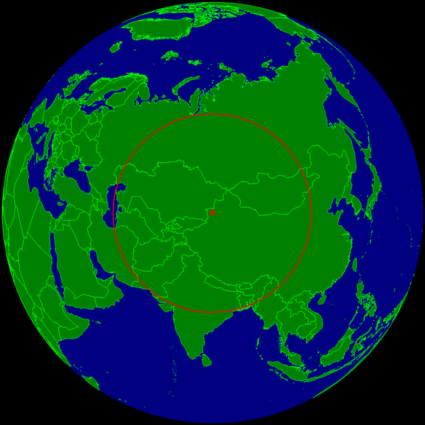
File:Continental pole of inaccessibility.png
Appearance

Size of this preview: 600 × 600 pixels. Other resolutions: 240 × 240 pixels | 480 × 480 pixels | 960 × 960 pixels.
Original file (960 × 960 pixels, file size: 152 KB, MIME type: image/png)
File history
Click on a date/time to view the file as it appeared at that time.
| Date/Time | Thumbnail | Dimensions | User | Comment | |
|---|---|---|---|---|---|
| current | 10:20, 24 March 2015 |  | 960 × 960 (152 KB) | RokerHRO | optipng -o7 -i0 → 29.75% decrease |
| 23:35, 25 July 2008 |  | 960 × 960 (216 KB) | Timwi | {{Information |Description={{en|1=Spherical Earth centered on the continental pole of inaccessibility in the middle of Eurasia. The circle indicates the distance to the nearest ocean (the body of water on the left is not co |
File usage
The following page uses this file:
Global file usage
The following other wikis use this file:
- Usage on ast.wikipedia.org
- Usage on ca.wikipedia.org
- Usage on de.wikipedia.org
- Usage on es.wikipedia.org
- Usage on et.wikipedia.org
- Usage on frr.wikipedia.org
- Usage on fr.wikipedia.org
- Usage on it.wikipedia.org
- Usage on ja.wikipedia.org
- Usage on lb.wikipedia.org
- Usage on pl.wikipedia.org
- Usage on pt.wikipedia.org
- Usage on ro.wikipedia.org
- Usage on sk.wikipedia.org
- Usage on uk.wikipedia.org
- Usage on vi.wikipedia.org
- Usage on www.wikidata.org
- Usage on zh.wikipedia.org

