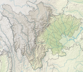
File:China Sichuan rel location map.svg
Appearance

Size of this PNG preview of this SVG file: 695 × 600 pixels. Other resolutions: 278 × 240 pixels | 556 × 480 pixels | 890 × 768 pixels | 1,187 × 1,024 pixels | 2,374 × 2,048 pixels | 1,370 × 1,182 pixels.
Original file (SVG file, nominally 1,370 × 1,182 pixels, file size: 1.21 MB)
File history
Click on a date/time to view the file as it appeared at that time.
| Date/Time | Thumbnail | Dimensions | User | Comment | |
|---|---|---|---|---|---|
| current | 18:10, 4 September 2023 |  | 1,370 × 1,182 (1.21 MB) | NordNordWest | upd |
| 12:00, 19 February 2022 |  | 1,370 × 1,182 (1.22 MB) | NordNordWest | == {{int:filedesc}} == {{Information |Description= {{de|1=Positionskarte von Sichuan, Volksrepublik China}} {{en|1=Location map of Sichuan, People's Republic of China}} {{Location map series N |stretching=115 |top=34.5 |bottom=25.8 |left=97.1 |right=108.7 }} |Source={{Own using}} * United States National Imagery and Mapping Agency data * World Data Base II data * ETOPO1 data |Date=2022-02-19 |Author={{U|NordNordWest}} |Permission= |other_versions=<gallery>China Sichuan adm location map.svg</g... |
File usage
The following 66 pages use this file:
- 1536 Xichang earthquake
- 1850 Xichang earthquake
- 1973 Luhuo earthquake
- 2013 Lushan earthquake
- 2014 Kangding earthquake
- 2017 Jiuzhaigou earthquake
- 2017 Sichuan landslide
- 2019 Zigong earthquake
- 2021 Luxian earthquake
- Changheba Dam
- Chengdu Huangcheng Mosque
- Conquest of Shu by Wei
- Dagangshan Dam
- Daliang Mountains
- Daxue Mountains
- Diexi Lake
- Dujiangyan
- Feitianshan Formation
- Ge'nyen Massif
- Hailuogou
- Huanglong Scenic and Historic Interest Area
- Jinping-II Dam
- Jinping-I Dam
- Jinping Mountains
- Leshan Giant Buddha
- Lugu Lake
- Mount Emei
- Mount Gongga
- Mount Pomiu
- Mount Qingcheng
- Mount Siguniang
- Pearl Shoal Waterfall
- Phoenix Mountain Mosque
- Pubugou Dam
- Qiong Lake
- Qionglai Mountains
- Rongme Ngatra
- Sanxingdui
- Shaximiao Formation
- Sichuan Giant Panda Sanctuaries
- Tangjiashan Lake
- Wolong National Nature Reserve
- Yihun Lhatso
- User:Dyadicdan/sandbox
- User:Ty654/List of earthquakes from 1900-1949 exceeding magnitude 7+
- User:Ty654/List of earthquakes from 1905-1909 exceeding magnitude 6+
- User:Ty654/List of earthquakes from 1910-1919 exceeding magnitude 6+
- User:Ty654/List of earthquakes from 1930-1939 exceeding magnitude 6+
- User:Ty654/List of earthquakes from 1950-1954 exceeding magnitude 6+
- User:Ty654/List of earthquakes from 1950-1999 exceeding magnitude 7+
- User:Ty654/List of earthquakes from 1955-1959 exceeding magnitude 6+
- User:Ty654/List of earthquakes from 1960-1964 exceeding magnitude 6+
- User:Ty654/List of earthquakes from 1965-1969 exceeding magnitude 6+
- User:Ty654/List of earthquakes from 1970-1974 exceeding magnitude 6+
- User:Ty654/List of earthquakes from 1975-1979 exceeding magnitude 6+
- User:Ty654/List of earthquakes from 1980-1984 exceeding magnitude 6+
- User:Ty654/List of earthquakes from 1985-1989 exceeding magnitude 6+
- User:Ty654/List of earthquakes from 2000-present exceeding magnitude 7+
- User:Ty654/List of earthquakes from 2005-2009 exceeding magnitude 6+
- User:Ty654/List of earthquakes from 2010-2014 exceeding magnitude 6+
- User:Ty654/List of earthquakes from 2015-2019 exceeding magnitude 6+
- Module:Location map/data/China Sichuan
- Module:Location map/data/China Sichuan/doc
- Module:Location map/data/China Sichuan topography
- Module:Location map/data/China Sichuan topography/doc
- Module:Location map/data/Sichuan
Global file usage
The following other wikis use this file:
- Usage on de.wikipedia.org
- Usage on es.wikipedia.org
- Usage on fr.wikipedia.org
- Usage on he.wikipedia.org
- Usage on hu.wikipedia.org
- Usage on ja.wikipedia.org
- Usage on os.wikipedia.org
- Usage on ru.wikipedia.org
View more global usage of this file.


