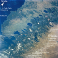
File:Chile.Los Lagos y Los Ríos.svg
Appearance

Size of this PNG preview of this SVG file: 600 × 600 pixels. Other resolutions: 240 × 240 pixels | 480 × 480 pixels | 768 × 768 pixels | 1,024 × 1,024 pixels | 2,048 × 2,048 pixels | 1,000 × 1,000 pixels.
Original file (SVG file, nominally 1,000 × 1,000 pixels, file size: 1.27 MB)
File history
Click on a date/time to view the file as it appeared at that time.
| Date/Time | Thumbnail | Dimensions | User | Comment | |
|---|---|---|---|---|---|
| current | 12:23, 17 May 2013 |  | 1,000 × 1,000 (1.27 MB) | Keysanger | {{Information |Description ={{en|1=Chile: Región de los Lagos, Región de los Ríos}} |Source =http://earth.jsc.nasa.gov/sseop/EFS/photoinfo.pl?PHOTO=NM23-764-236 |Author =NASA+Createaccount |Date ... |
File usage
The following 29 pages use this file:
- Allipén River
- Biobío River
- Budi Lake
- Caburgua Lake
- Calafquén Lake
- Cautín River
- Chilean Lake District
- Cholchol River
- Colico Lake
- Conguillío Lake
- Cruces River
- Galletué Lake
- Icalma Lake
- Imperial River (Chile)
- Lake Villarrica
- List of lakes of Chile
- Liucura River
- Llanquihue glaciation
- Lonquimay River
- Malleco River
- Muco River
- Ojos del Caburgua
- Quepe River
- Reigolil River
- Tinquilco Lake
- Toltén River
- Trancura River
- Trufultruful River
- Template:Araucanía Region rivers and lakes
Global file usage
The following other wikis use this file:
- Usage on es.wikipedia.org
- Usage on fr.wikipedia.org
- Usage on ru.wikipedia.org
- Usage on uk.wikipedia.org


