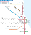
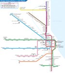
File:Chicago L diagram sb.svg
Appearance

Size of this PNG preview of this SVG file: 535 × 600 pixels. Other resolutions: 214 × 240 pixels | 428 × 480 pixels | 685 × 768 pixels | 913 × 1,024 pixels | 1,827 × 2,048 pixels | 1,650 × 1,850 pixels.
Original file (SVG file, nominally 1,650 × 1,850 pixels, file size: 48 KB)
File history
Click on a date/time to view the file as it appeared at that time.
| Date/Time | Thumbnail | Dimensions | User | Comment | |
|---|---|---|---|---|---|
| current | 05:36, 23 January 2023 |  | 1,650 × 1,850 (48 KB) | Sameboat | Add Purple Express stop at Wilson station |
| 00:13, 7 January 2021 |  | 1,650 × 1,850 (48 KB) | Sameboat | fix blur line station icons | |
| 02:36, 30 December 2020 |  | 1,650 × 1,850 (48 KB) | Sameboat | wrap all <defs> instances in <g id="xxx"> | |
| 14:54, 15 July 2018 |  | 1,650 × 1,850 (48 KB) | Sameboat | doctype | |
| 02:40, 4 September 2017 |  | 1,650 × 1,850 (48 KB) | Sameboat | Purple rush in legend | |
| 01:42, 4 September 2017 |  | 1,650 × 1,850 (48 KB) | Sameboat | minor fix of the blur filter | |
| 14:26, 1 September 2017 |  | 1,650 × 1,850 (48 KB) | Sameboat | ||
| 08:22, 1 September 2017 |  | 1,650 × 1,850 (46 KB) | Sameboat | Randolph/Wabash -> Washington/Wabash; style change of single-way loop entrance indication | |
| 02:24, 8 August 2017 |  | 1,650 × 1,850 (45 KB) | Sameboat | Planned Damen station (Green line) and few minor adjustments. | |
| 02:28, 4 March 2016 |  | 1,650 × 1,850 (44 KB) | Sameboat | + river |
File usage
The following 6 pages use this file:
Global file usage
The following other wikis use this file:
- Usage on bn.wikipedia.org
- Usage on bn.wikivoyage.org
- Usage on cy.wikipedia.org
- Usage on de.wikipedia.org
- Usage on en.wikivoyage.org
- Usage on eo.wikipedia.org
- Usage on es.wikipedia.org
- Usage on fa.wikipedia.org
- Usage on fi.wikipedia.org
- Usage on fr.wikipedia.org
- Usage on he.wikipedia.org
- Usage on he.wikivoyage.org
- Usage on hu.wikipedia.org
- Usage on id.wikipedia.org
- Usage on it.wikipedia.org
- Usage on ja.wikipedia.org
- Usage on ko.wikipedia.org
- Usage on pl.wikipedia.org
- Usage on ru.wikipedia.org
- Usage on simple.wikipedia.org
- Usage on sr.wikipedia.org
- Usage on th.wikipedia.org
- Usage on tr.wikipedia.org
- Usage on uk.wikipedia.org
- Usage on www.wikidata.org
- Usage on zh.wikipedia.org


