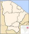
File:Ceara MesoMicroMunicip.svg
Appearance

Size of this PNG preview of this SVG file: 502 × 599 pixels. Other resolutions: 201 × 240 pixels | 402 × 480 pixels | 643 × 768 pixels | 857 × 1,024 pixels | 1,715 × 2,048 pixels | 829 × 990 pixels.
Original file (SVG file, nominally 829 × 990 pixels, file size: 388 KB)
File history
Click on a date/time to view the file as it appeared at that time.
| Date/Time | Thumbnail | Dimensions | User | Comment | |
|---|---|---|---|---|---|
| current | 23:45, 11 August 2011 |  | 829 × 990 (388 KB) | Marquinhos | Standardization with other versions of maps that are loaded by Raphael Lorenzeto de Abreu. |
| 09:55, 29 April 2006 |  | 581 × 684 (361 KB) | Raphael.lorenzeto | {{Information| |Description=Map of Ceará state |Source=own work |Date=April, 29 2006 |Author=Raphael Lorenzeto de Abreu |Permission={{self2|GFDL|cc-by-2.5}} |other_versions= }} Category:Maps of Ceará |
File usage
No pages on the English Wikipedia use this file (pages on other projects are not listed).
Global file usage
The following other wikis use this file:
- Usage on eo.wikipedia.org
- Usage on es.wikipedia.org
- Usage on fr.wikipedia.org
- Usage on pt.wikipedia.org
- Usage on pt.wikinews.org
- Usage on pt.wiktionary.org
- Usage on zh.wikipedia.org


