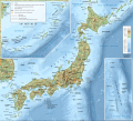
File:Carte topographique du Japon-fr.svg
Appearance

Size of this PNG preview of this SVG file: 661 × 600 pixels. Other resolutions: 265 × 240 pixels | 529 × 480 pixels | 846 × 768 pixels | 1,129 × 1,024 pixels | 2,257 × 2,048 pixels | 2,322 × 2,107 pixels.
Original file (SVG file, nominally 2,322 × 2,107 pixels, file size: 3.91 MB)
File history
Click on a date/time to view the file as it appeared at that time.
| Date/Time | Thumbnail | Dimensions | User | Comment | |
|---|---|---|---|---|---|
| current | 22:52, 25 March 2017 |  | 2,322 × 2,107 (3.91 MB) | Bourrichon | Correction des noms de quelques toponymes |
| 17:45, 30 August 2013 |  | 2,322 × 2,107 (3.91 MB) | Bourrichon | correction mont Kōya et Kōfu | |
| 13:11, 12 July 2013 |  | 2,322 × 2,107 (3.91 MB) | Bourrichon | détails | |
| 19:39, 11 July 2013 |  | 2,322 × 2,107 (3.76 MB) | Bourrichon | -petite erreur (longue ligne noire tout en bas de l'image), +tri dans les calques | |
| 18:28, 11 July 2013 |  | 2,322 × 2,112 (3.78 MB) | Bourrichon | +coord | |
| 18:26, 11 July 2013 |  | 2,322 × 2,112 (3.76 MB) | Bourrichon | == {{int:filedesc}} == {{Information |Description= {{fr|Carte topographique et administrative en français du fr:Japon}} {{de|Topographische Karte / StraßenkarteJapans, in Französische.}} {{en|Topographic and administrative map ... |
File usage
No pages on the English Wikipedia use this file (pages on other projects are not listed).
Global file usage
The following other wikis use this file:
- Usage on avk.wikipedia.org
- Usage on en.wiktionary.org
- Usage on fr.wikipedia.org
- Usage on ja.wikipedia.org
- Usage on ja.wiktionary.org
- Usage on la.wikipedia.org
- Usage on mnw.wiktionary.org
- Usage on www.wikidata.org
- Usage on zh.wiktionary.org


