File:Canton RR map.jpg
Appearance
Canton_RR_map.jpg (351 × 380 pixels, file size: 77 KB, MIME type: image/jpeg)
File history
Click on a date/time to view the file as it appeared at that time.
| Date/Time | Thumbnail | Dimensions | User | Comment | |
|---|---|---|---|---|---|
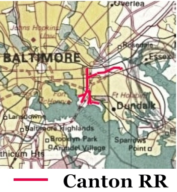
| current | 23:15, 6 April 2021 |  | 351 × 380 (77 KB) | JGHowes | |Description={{w|Canton Railroad}} (in <font color=red>'''RED'''</font color>), {{w|Baltimore, Maryland}}, U.S. |Source=Derived from [http://www.lib.utexas.edu/maps/world_cities/washington_baltimore.jpg 1970 National Atlas Map] |Date={{upload date|2021-04-06}} |Author=Derivative by JGHowes |Permission= |other_versions= }} == {{int:license-header}} == Source file: {{PD-USGov-Atlas}} Derivative: {{cc-by-sa-4.0|1=JGHowes}} Category:Canton Railroad [[Category:Rail transpor... |
File usage
The following page uses this file:


