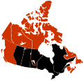
File:Canada swine flu map.svg
Appearance

Size of this PNG preview of this SVG file: 617 × 599 pixels. Other resolutions: 247 × 240 pixels | 494 × 480 pixels | 791 × 768 pixels | 1,054 × 1,024 pixels | 2,108 × 2,048 pixels | 978 × 950 pixels.
Original file (SVG file, nominally 978 × 950 pixels, file size: 76 KB)
File history
Click on a date/time to view the file as it appeared at that time.
| Date/Time | Thumbnail | Dimensions | User | Comment | |
|---|---|---|---|---|---|
| current | 00:17, 4 August 2009 |  | 978 × 950 (76 KB) | Fonadier | Fixed colors |
| 15:15, 2 August 2009 |  | 978 × 950 (64 KB) | SpaceFlight89 | Derivative of previous version; update contributed by 76.66.202.123 | |
| 09:18, 18 July 2009 |  | 978 × 950 (64 KB) | Graeme Bartlett | 76.66.192.91 bugfix - Akimiski Island -- derived from File:Canada swine flu map.svg & File:H1N1 Canada human swine flu - deaths - CSS map.svg | |
| 22:48, 17 July 2009 |  | 978 × 950 (71 KB) | AxG | Rm layering | |
| 06:23, 17 July 2009 |  | 978 × 950 (76 KB) | Vrysxy | updated | |
| 05:46, 15 July 2009 |  | 978 × 950 (76 KB) | Vrysxy | Updating | |
| 12:55, 11 July 2009 |  | 978 × 950 (64 KB) | Graeme Bartlett | contributed by 70.29.208.69 – derived from File:Canada swine flu map.svg - fix Anticosti Island Comment: This map is internally coded like the deaths map, but coloured like the types map [[:en:Wikipedia talk:Images for upload/svg/Canada swine flu map | |
| 20:47, 28 June 2009 |  | 978 × 950 (75 KB) | Vrysxy | updating | |
| 14:59, 21 June 2009 |  | 978 × 950 (75 KB) | HotWikiBR | Fixing Anticosti Island. | |
| 21:35, 16 June 2009 |  | 978 × 950 (75 KB) | Vrysxy | First death in Manitoba - Premier décès au Manitoba |
File usage
The following 4 pages use this file:
Global file usage
The following other wikis use this file:
- Usage on fr.wikinews.org


