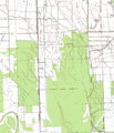
File:CampBMap.PNG
Appearance

Size of this preview: 515 × 599 pixels. Other resolutions: 206 × 240 pixels | 413 × 480 pixels | 660 × 768 pixels | 880 × 1,024 pixels | 1,613 × 1,876 pixels.
Original file (1,613 × 1,876 pixels, file size: 3.1 MB, MIME type: image/png)
File history
Click on a date/time to view the file as it appeared at that time.
| Date/Time | Thumbnail | Dimensions | User | Comment | |
|---|---|---|---|---|---|
| current | 15:54, 1 May 2011 |  | 1,613 × 1,876 (3.1 MB) | WhisperToMe | {{Information |Description ={{en|1=Topographic map of Camp B, a unit of the Mississippi State Penitentiary}} {{es|1=Mapa topográfico del Campo B, una unidad de la ''[[:es:Mississippi State Penitentiary|Mississipp |
File usage
The following page uses this file:

