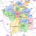
File:Cambridge UK ward map 2010 coloured on Cambridge-Openstreetmap-08-06-13.svg
Appearance

Size of this PNG preview of this SVG file: 600 × 600 pixels. Other resolutions: 240 × 240 pixels | 480 × 480 pixels | 768 × 768 pixels | 1,024 × 1,024 pixels | 2,048 × 2,048 pixels.
Original file (SVG file, nominally 1,024 × 1,024 pixels, file size: 335 KB)
File history
Click on a date/time to view the file as it appeared at that time.
| Date/Time | Thumbnail | Dimensions | User | Comment | |
|---|---|---|---|---|---|
| current | 21:46, 8 September 2017 |  | 1,024 × 1,024 (335 KB) | Cmglee | Add postcode outward code boundaries. |
| 19:36, 13 May 2014 |  | 588 × 588 (334 KB) | Cmglee | Extend area to avoid truncating Trumpington, and brighten background. | |
| 16:13, 21 April 2014 |  | 575 × 575 (465 KB) | Cmglee | User created page with UploadWizard |
File usage
The following 4 pages use this file:
Global file usage
The following other wikis use this file:
- Usage on azb.wikipedia.org
- Usage on de.wikipedia.org
- Usage on fr.wikipedia.org
- Usage on hy.wikipedia.org
- Usage on it.wikipedia.org
- Usage on pl.wikipedia.org
- Usage on ru.wikipedia.org
- Usage on sl.wikipedia.org


