Jump to content

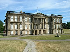
File:Calke Abbey.jpg

Page contents not supported in other languages.
This is a file from the Wikimedia Commons
From Wikipedia, the free encyclopedia

Original file (2,379 × 1,681 pixels, file size: 3.54 MB, MIME type: image/jpeg)

Summary

Object

Calke Abbey  wikidata:Q5021459 reasonator:Q5021459
Title
Calke Abbey
label QS:Lit,"Calke Abbey"
label QS:Lja,"コーク・アビイ"
label QS:Lfr,"abbaye de Calke"
label QS:Lnb,"Calby Abbey"
label QS:Lde,"Calke Abbey"
label QS:Len,"Calke Abbey"
label QS:Lga,"Calke Abbey"
label QS:Lzh,"卡爾克莊園"
label QS:Lda,"Calby Abbey"
image of artwork listed in title parameter on this page
Part of National Trust Edit this at Wikidata
Object type historic house museum / English country house Edit this at Wikidata
Description
English: Calke Abbey Calke Abbey is a baroque mansion owned by the National Trust and set in 600 acres of Calke Park National Nature Reserve. It was founded as an Augustinian priory by the 2nd Earl of Chester in the early 12th century and never progressed to become an abbey. By the mid 1100s it was already reduced to serving nearby Repton Priory and continued as such until the Dissolution in the 16th century. It then passed through the hands of many owners, gaining the name Calke Abbey in 1808, before being passed to the National Trust in the 1980s. Nothing of the original building remains, the earliest masonry being Elizabethan. It was largely rebuilt in 1701-1704.
Date 1704 Edit this at Wikidata
Object location
52° 47′ 59″ N, 1° 27′ 21″ W Edit this at Structured Data on Commons Kartographer map based on OpenStreetMap.View this and other nearby images on: OpenStreetMapinfo
References www.nationaltrust.org.uk/main/w-vh/w-visits/w-findaplace/...
Authority file
Other versions

Photograph

Date
Source Calke Abbey * Uploaded by oxyman
Author Phil Sangwell from United Kingdom
Camera location52° 47′ 38.54″ N, 1° 26′ 52.54″ W Kartographer map based on OpenStreetMap.View this and other nearby images on: OpenStreetMapinfo

Licensing

w:en:Creative Commons
attribution
This file is licensed under the Creative Commons Attribution 2.0 Generic license.
You are free:
  • to share – to copy, distribute and transmit the work
  • to remix – to adapt the work
Under the following conditions:
  • attribution – You must give appropriate credit, provide a link to the license, and indicate if changes were made. You may do so in any reasonable manner, but not in any way that suggests the licensor endorses you or your use.
This image, originally posted to Flickr, was reviewed on May 12, 2011 by the administrator or reviewer File Upload Bot (Magnus Manske), who confirmed that it was available on Flickr under the stated license on that date.

Captions

Add a one-line explanation of what this file represents

Items portrayed in this file

depicts

52°47'38.544"N, 1°26'52.544"W

2 May 2011

52°47'58.99999"N, 1°27'20.99999"W

0.001 second

17 millimetre

image/jpeg

b62b85431a38c71f5d79f9bf81e049d7c12868cc

3,710,841 byte

1,681 pixel

2,379 pixel

File history

Click on a date/time to view the file as it appeared at that time.

Date/TimeThumbnailDimensionsUserComment
current17:05, 12 May 2011Thumbnail for version as of 17:05, 12 May 20112,379 × 1,681 (3.54 MB)File Upload Bot (Magnus Manske){{Information |Description=[http://www.nationaltrust.org.uk/main/w-vh/w-visits/w-findaplace/w-calkeabbey/ www.nationaltrust.org.uk/main/w-vh/w-visits/w-findaplace/...] |Source=[http://www.flickr.com/photos/onemananhisdog/5681274300/ Calke Abbey] * Uploade

The following page uses this file:

Global file usage

The following other wikis use this file:

Metadata