
File:Caert van't Landt van d'Eendracht (detail showing Land of the Leeuwin).jpg
Size of this preview: 800 × 448 pixels. Other resolutions: 320 × 179 pixels | 640 × 358 pixels | 1,051 × 588 pixels.
Original file (1,051 × 588 pixels, file size: 130 KB, MIME type: image/jpeg)
| This is a file from the Wikimedia Commons. Information from its description page there is shown below. Commons is a freely licensed media file repository. You can help. |
.jpg)
| Description |
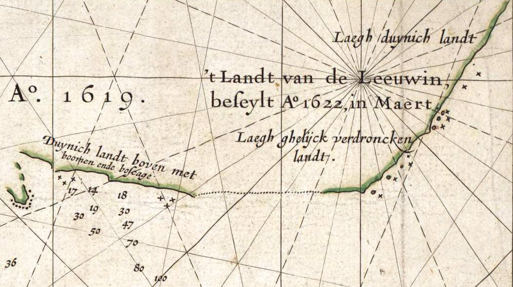
This is an image showing detail of the National Library of Australia's copy of Hessel Gerritsz' 1627 map of the west coast of Australia entitled "Caert van't Landt van d'Eendracht". This detail shows a section of coastline discovered by the Leeuwin in 1622, and subsequently referred to by the Dutch as 't Landt van de Leeuwin ("The Land of the Leeuwin") |
|||||
| Date | The original map was published in 1627. | |||||
| Source | Cropped from the full scan, available at Image:Caert van't Landt van d'Eendracht (NLA).jpg, then colour balanced. | |||||
| Author | Hessel Gerritsz, also written "Hessel Gerritszoon". | |||||
| Permission (Reusing this file) |
|
|||||
| Other versions | For other versions, see Category:Caert van't Landt van d'Eendracht. | |||||
.jpg)
File history
Click on a date/time to view the file as it appeared at that time.
| Date/Time | Thumbnail | Dimensions | User | Comment | |
|---|---|---|---|---|---|
| current | 12:24, 30 January 2008 | | 1,051 × 588 (130 KB) | Hesperian | {{Information |Description=This is an image showing detail of the National Library of Australia's copy of Hessel Gerritsz' 1627 map of the west coast of Australia entitled "Caert van't Landt van d'Eendracht". This detail shows a section of coastline disc |
File usage
The following page uses this file:
Global file usage
The following other wikis use this file:
- Usage on nl.wikipedia.org
.jpg)