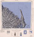
File:C71188s5 Ant.Map Cape Adare.jpg
Appearance

Size of this preview: 557 × 599 pixels. Other resolutions: 223 × 240 pixels | 446 × 480 pixels | 714 × 768 pixels | 952 × 1,024 pixels | 1,903 × 2,048 pixels | 2,877 × 3,096 pixels.
Original file (2,877 × 3,096 pixels, file size: 1.53 MB, MIME type: image/jpeg)
File history
Click on a date/time to view the file as it appeared at that time.
| Date/Time | Thumbnail | Dimensions | User | Comment | |
|---|---|---|---|---|---|
| current | 12:47, 26 November 2015 |  | 2,877 × 3,096 (1.53 MB) | ValeriySh | Обрізка зайвого поля |
| 16:43, 3 April 2005 |  | 3,506 × 3,260 (1.67 MB) | Achim Raschka | Map of Antarctica by the United States Antarctic Ressource Center of the US Geological Society. {{PD-US}} Copyrights and Trademarks USGS-authored or produced data and information are in the public domain. While the content of most USGS web pages is in th |
File usage
The following 12 pages use this file:
Global file usage
The following other wikis use this file:
- Usage on ar.wikipedia.org
- Usage on ast.wikipedia.org
- Usage on az.wikipedia.org
- Usage on be.wikipedia.org
- Usage on bg.wikipedia.org
- Usage on ceb.wikipedia.org
- Usage on de.wikipedia.org
- Usage on el.wikipedia.org
- Usage on eo.wikipedia.org
- Usage on es.wikipedia.org
- Usage on fr.wikipedia.org
- Usage on he.wikipedia.org
- Usage on id.wikipedia.org
- Usage on it.wikipedia.org
- Capo Adare
- Costa di Pennell
- Monti dell'Ammiragliato
- Ghiacciaio Man-o-War
- Ghiacciaio Fitch
- Ghiacciaio Deming
- Ghiacciaio Massey
- Ghiacciaio Moubray
- Ghiacciaio Slone
- Ghiacciaio DeAngelo
- Ghiacciaio Fowlie
- Ghiacciaio Fendley
- Ghiacciaio Pitkevitch
- Ghiacciaio Shipley
- Ghiacciaio Crume
- Ghiacciaio Ommanney
- Ghiacciaio Murray
- Isola del Duca di York (Antartide)
- Isola Flat
- Isola Turret
- Ghiacciaio Nielsen
- Ghiacciaio Egeberg
View more global usage of this file.

