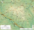
File:Bulgaria geographic map Sakar bg.svg
Appearance

Size of this PNG preview of this SVG file: 669 × 599 pixels. Other resolutions: 268 × 240 pixels | 536 × 480 pixels | 857 × 768 pixels | 1,143 × 1,024 pixels | 2,286 × 2,048 pixels | 2,232 × 2,000 pixels.
Original file (SVG file, nominally 2,232 × 2,000 pixels, file size: 6.57 MB)
File history
Click on a date/time to view the file as it appeared at that time.
| Date/Time | Thumbnail | Dimensions | User | Comment | |
|---|---|---|---|---|---|
| current | 07:46, 22 September 2018 |  | 2,232 × 2,000 (6.57 MB) | Ikonact | added name |
| 22:02, 21 September 2018 |  | 2,232 × 2,000 (6.57 MB) | Ikonact | == {{int:filedesc}} == {{Information |description={{en|1=Geographic map of Sakar mountain, Bulgaria in Bulgarian. Geographic limits of the map:}} {{bg|1=Географска карта на Сакар. Карта на български. Граници на картата:}} *N: 41.68° N *S: 42.18° N *W: 25.85° E *E: 26.60° E Projection: Equidistant Cylindrical |date=2018-09-21 |source={{own}} *Sources of data:<br/> **Topography: NASA SRTM3 v3; **Other data: © OpenStreetMap contributors<br/> *Tool:<br... |
File usage
No pages on the English Wikipedia use this file (pages on other projects are not listed).
Global file usage
The following other wikis use this file:
- Usage on bg.wikipedia.org
- Usage on www.wikidata.org


