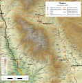
File:Bulgaria Pirin mountain geographic map bg.svg
Appearance

Size of this PNG preview of this SVG file: 597 × 599 pixels. Other resolutions: 239 × 240 pixels | 478 × 480 pixels | 765 × 768 pixels | 1,020 × 1,024 pixels | 2,039 × 2,048 pixels | 1,200 × 1,205 pixels.
Original file (SVG file, nominally 1,200 × 1,205 pixels, file size: 6.75 MB)
File history
Click on a date/time to view the file as it appeared at that time.
| Date/Time | Thumbnail | Dimensions | User | Comment | |
|---|---|---|---|---|---|
| current | 09:49, 11 October 2017 |  | 1,200 × 1,205 (6.75 MB) | Ikonact | peak name position corrected |
| 09:46, 11 October 2017 |  | 1,200 × 1,205 (6.7 MB) | Ikonact | improvements | |
| 22:14, 27 September 2017 |  | 1,200 × 1,205 (6.1 MB) | Ikonact | few more peaks | |
| 21:40, 27 September 2017 |  | 1,200 × 1,205 (5.93 MB) | Ikonact | =={{int:filedesc}}== {{Information |description={{en|1=Geographic map of Pirin, Bulgaria mountain in Bulgarian. Geographic limits of the map:}} {{bg|1=Географска карта на планина [[:bg:Пирин|... |
File usage
The following page uses this file:
Global file usage
The following other wikis use this file:
- Usage on bg.wikipedia.org
- Usage on es.wikipedia.org
- Usage on fa.wikipedia.org
- Usage on hu.wikipedia.org
- Usage on mk.wikipedia.org
- Usage on sl.wikipedia.org
- Usage on www.wikidata.org

