Jump to content

File:Buayan.png

Page contents not supported in other languages.
This is a file from the Wikimedia Commons
From Wikipedia, the free encyclopedia

Original file (1,601 × 1,528 pixels, file size: 95 KB, MIME type: image/png)

Summary

Description
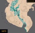
English: A map of the maximum extent of Datu Uto's territory.)
Date
Source

Original work by DeliriumMaps (Delirium333). The information was gathered from the following sources:

  • Wikipedia
  • 'WE ARE MANY NATIONS: THE EMERGENCE OF A MULTI-ETHNIC MAGUINDANAO SULTANATE' (1986) by Ruurdje Laarhoven
  • 'Studies in Moro History, Law, and Religion' (1905) by Najeeb M. Saleeby
  • 'Magindanao 1860-1888: The Career of Datu Uto of Buayan' (1970) by Reynaldo C. Ileto
  • No. 27. Mindanao Oriental. Islas Filipinas Observatorio de Manila. United States Coast and Geodetic Survey. No. 27. Longitud E. del Meridiano de Greenwich.' A. Hoen and Co. (1899)
  • https://borneohistory57.blogspot.com/2016/05/sultanate-of-buayan.html (use with caution)
Author Delirium333

Licensing

I, the copyright holder of this work, hereby publish it under the following license:
w:en:Creative Commons
attribution share alike
This file is licensed under the Creative Commons Attribution-Share Alike 4.0 International license.
You are free:
  • to share – to copy, distribute and transmit the work
  • to remix – to adapt the work
Under the following conditions:
  • attribution – You must give appropriate credit, provide a link to the license, and indicate if changes were made. You may do so in any reasonable manner, but not in any way that suggests the licensor endorses you or your use.
  • share alike – If you remix, transform, or build upon the material, you must distribute your contributions under the same or compatible license as the original.

Captions

Add a one-line explanation of what this file represents

Items portrayed in this file

depicts

25 March 2022

image/png

1b6576e49ac8fb0326c24dbd5fbf6fcaa306ad0c

97,195 byte

1,528 pixel

1,601 pixel

File history

Click on a date/time to view the file as it appeared at that time.

(newest | oldest) View (newer 10 | ) (10 | 20 | 50 | 100 | 250 | 500)
Date/TimeThumbnailDimensionsUserComment
current02:46, 8 October 2023Thumbnail for version as of 02:46, 8 October 20231,601 × 1,528 (95 KB)Delirium333making sugud buayan's color and borders more visible
01:34, 6 October 2023Thumbnail for version as of 01:34, 6 October 20231,601 × 1,528 (95 KB)Delirium333changed the spelling of tinungkup, from tinungkut to tinungkup
10:05, 2 October 2023Thumbnail for version as of 10:05, 2 October 20231,601 × 1,528 (95 KB)Delirium333fixed the location of the buayan capital in accordance to information regarding the capital of buayan at the time of datu utto's reign
04:35, 2 October 2023Thumbnail for version as of 04:35, 2 October 20231,601 × 1,528 (95 KB)Delirium333added dansalan settlement near the pulangi marshlands
02:35, 2 October 2023Thumbnail for version as of 02:35, 2 October 20231,601 × 1,528 (95 KB)Delirium333rakungan added
23:55, 30 September 2023Thumbnail for version as of 23:55, 30 September 20231,601 × 1,528 (94 KB)Delirium333removed a mistake which was including arumanen manobo settlements as aprt of buayan, when theres no evidence it was ever a part of buayan
14:48, 25 September 2023Thumbnail for version as of 14:48, 25 September 20231,601 × 1,528 (94 KB)Delirium333update regarding the sultanates in sarangani, more sarangani sultanates added
14:07, 25 September 2023Thumbnail for version as of 14:07, 25 September 20231,601 × 1,528 (94 KB)Delirium333i cant help myself but to put more changes
13:25, 25 September 2023Thumbnail for version as of 13:25, 25 September 20231,601 × 1,528 (93 KB)Delirium333added more sultanates
12:43, 25 September 2023Thumbnail for version as of 12:43, 25 September 20231,601 × 1,528 (93 KB)Delirium333idalemen tribe made more detailed
(newest | oldest) View (newer 10 | ) (10 | 20 | 50 | 100 | 250 | 500)

The following 2 pages use this file:

Global file usage

The following other wikis use this file:

Metadata