File:BrunswickDistrict6Map.jpg
Appearance

Size of this preview: 661 × 600 pixels. Other resolutions: 264 × 240 pixels | 529 × 480 pixels | 846 × 768 pixels | 1,128 × 1,024 pixels | 1,515 × 1,375 pixels.
Original file (1,515 × 1,375 pixels, file size: 1.97 MB, MIME type: image/jpeg)
File history
Click on a date/time to view the file as it appeared at that time.
| Date/Time | Thumbnail | Dimensions | User | Comment | |
|---|---|---|---|---|---|
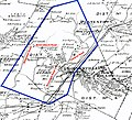
| current | 08:34, 23 June 2009 |  | 1,515 × 1,375 (1.97 MB) | MattWade | {{Information |Description=Map of Brunswick District #6 school district, incorporated into en:Brunswick (Brittonkill) Central School District in 1956 |Source=Rensselaer County Atlas |Date=1876 |Au |
File usage
The following page uses this file:
Global file usage
The following other wikis use this file:
- Usage on de.wikipedia.org

