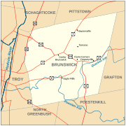
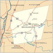
File:Brunswick, New York Map2.svg
Appearance

Size of this PNG preview of this SVG file: 600 × 600 pixels. Other resolutions: 240 × 240 pixels | 480 × 480 pixels | 768 × 768 pixels | 1,024 × 1,024 pixels | 2,048 × 2,048 pixels | 765 × 765 pixels.
Original file (SVG file, nominally 765 × 765 pixels, file size: 83 KB)
File history
Click on a date/time to view the file as it appeared at that time.
| Date/Time | Thumbnail | Dimensions | User | Comment | |
|---|---|---|---|---|---|
| current | 03:08, 4 January 2010 |  | 765 × 765 (83 KB) | ZooFari | Adding route signs and village/city coordinates |
| 15:45, 30 December 2009 |  | 765 × 765 (41 KB) | Kmusser | Added river labels | |
| 16:30, 29 December 2009 |  | 765 × 765 (38 KB) | Kmusser | attempt font fix | |
| 16:27, 29 December 2009 |  | 765 × 765 (38 KB) | Kmusser | {{Information |Description=Map of Brunswick, New York, United States. |Source={{own}} Township and county boundaries from the U.S. Census Bureau [http://www.census.gov/geo/www/cob/bdy_files.h |
File usage
No pages on the English Wikipedia use this file (pages on other projects are not listed).


